")
")
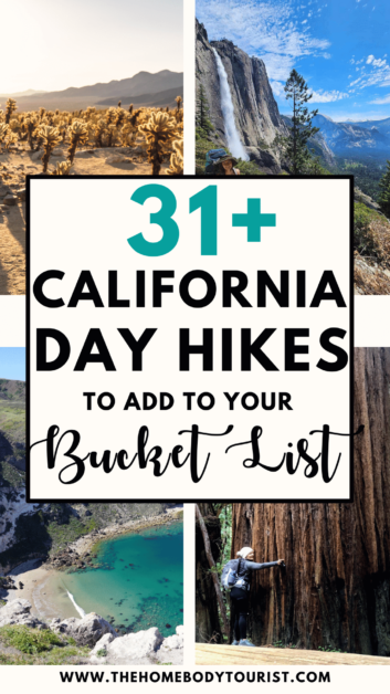
31 Breathtaking California Day Hikes
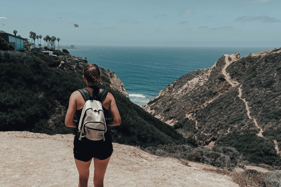
From the towering peaks of Yosemite National Park to the rugged beauty of Big Sur’s coastline, California offers an ABUNDANCE of breathtaking day hikes that cater to ALL skill levels. AND if you know me, you know I appreciate a good day hike followed by a juicy burger, shower and cozy bed. 🙂 I haven’t been able to explore all of California yet, so I reached out to fellow day-hikers to create this ultimate list of breathtaking California day hikes to add to your bucket list.
This post contains affiliate links to products. I may receive a commission for purchases made through these links at no extra cost to you. I only recommend products I truly love 🙂
Table of Contents
California Day Hikes Map
California Hiking Trails Packing list
I’m a firm believer that you do not need the best of the best supplies to get outside and start day hiking! Truthfully, you do not even need a lot of supplies. Here’s a quick list of the essentials though!
- Backpack with a hydration bladder (I’ve been using this cheap one from Amazon for 5+ years now!!)
- Headlamp (if you want to do any sunrise or sunset hikes)
- Hiking shoes of your choice (I typically wear my keen sandals on any hike under 5 miles and then switch to my boots for longer day hikes)
- SNACKS. SNACKS. AND MORE SNACKS.
- Layers if needed (I like to bring Merino Wool layers! WoolX is my fav company!)
- Extra water bottle if you want to mix in any electrolyte or caffeine packets!
- Doggy bags, water bowl, & leash (If hiking with your pup!)
Best Day Hikes in California
I have sorted through the list below based on region to make it easy for you to plan your bucket list. You’ll find epic hikes in Northern California, Southern California, Yosemite, Death Valley, hikes near Los Angeles, and more!
Happy hiking!
Northern California Hiking Trails
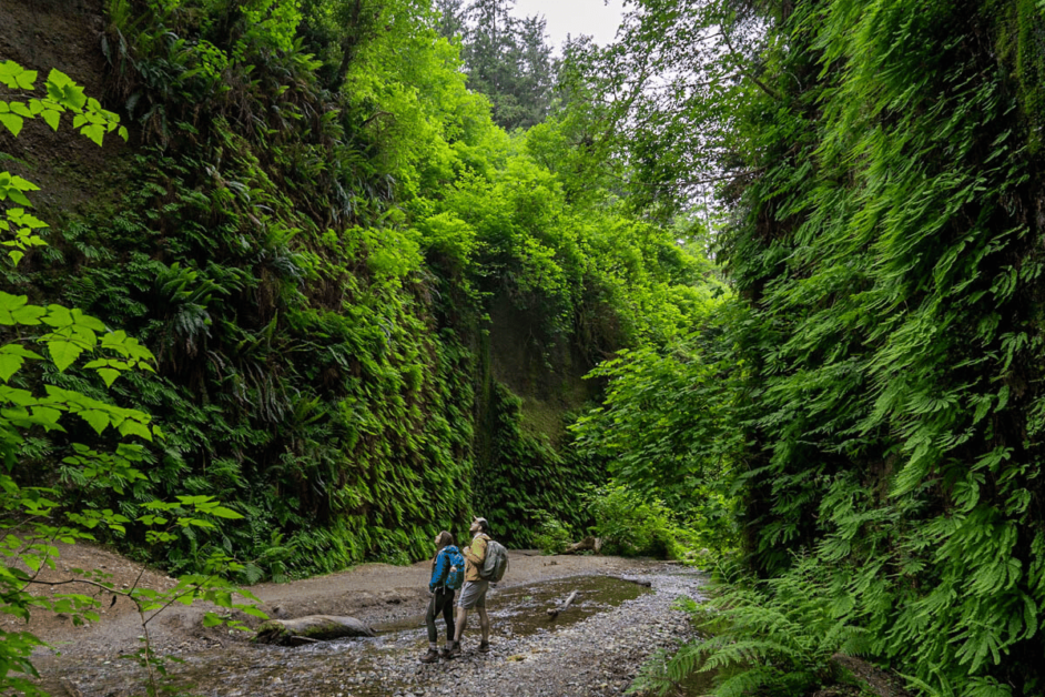
1. Fern Canyon Trail
- Location: Prairie Creek Redwood State Park in Orick, California.
- Length: 1.1 miles
- Difficulty: Easy
- Dog Friendly: No
The Fern Canyon trail offers a little bit of everything – a lush redwood forest, abundant wildlife, and, of course, canyon walls that are dripping with enormous primeval ferns. In fact, it looks so prehistoric that it was actually used as a filming location in The Lost World: Jurassic Park.
To enjoy this trail for yourself, you’ll need to reserve a free online permit ahead of time for the date that you want to visit. This is definitely an important step, as the rangers are absolute sticklers about only letting permit-holders into this section of the park and even require checking your ID to confirm that it matches the name on the reservation.
Getting here itself is also a bit of an adventure—the trailhead is fairly remote and found at the end of a windy access road in the middle of the forest. The road has plenty of bumps along the way and even two stream crossings, so driving here in a high clearance, four-wheel drive vehicle is recommended.
Before reaching the trailhead, you’ll need to stop at a fee station and pay a $12 entrance fee or, alternatively, present either an America the Beautiful pass, a California State Parks annual pass, or a current camping reservation in the park.
While you need to do a bit of work to hike on this iconic trail, the jaw-dropping views of Fern Canyon are absolutely worth it. Just make sure to bring along waterproof boots—for a significant portion of the trail, you’ll need to hike in ankle-deep—and cold!-water.
As experienced by Jess of Uprooted Traveler
2. Lake Siskiyou
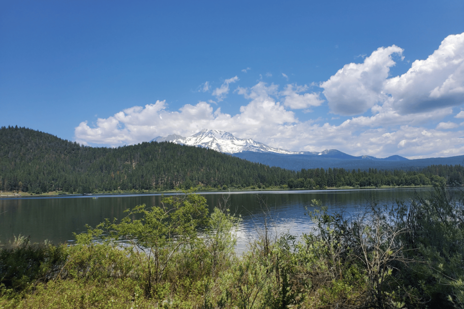
- Location: Near Mt. Shasta, California
- Length: 7 miles for the entire loop
- Difficulty: Easy-moderate
- Dog-friendly?: Yes
Lake Siskiyou is located in Siskiyou County, near the town of Mount Shasta. It’s a beautiful destination for outdoor enthusiasts, offering a variety of hiking trails that cater to different skill levels.
The Lake Siskiyou Trail is approximately 7 miles long and encircles the entire lake. It offers breathtaking views of Mt. Shasta, as well as opportunities for birdwatching and wildlife spotting. Keep in mind that parts of the trail can be steep and rocky, so proper footwear and caution are advised.
For an easier hike try the Box Canyon Dam Trail. This trail is approximately 2.7 miles long and offers stunning views of the lake and surrounding mountains. It’s a relatively easy hike, making it suitable for beginners or for a leisurely stroll.
You can take your dog with you on the trails. However, dogs are not allowed on the swimming beach.
There is a $3 entrance fee per person to enter the recreation area where you’ll find camping and a shady picnic area. There’s also a small restaurant and gift shop.
There are parking areas in various locations around the lake so you can start your hike from outside the recreation area.
After your hike, you can refresh yourself in the cool waters of the lake. You can relax on the sandy beach, or find a more secluded swimming cove.
Whether you’re a beginner or an experienced hiker, the trails at Lake Siskiyou provide a beautiful and enjoyable experience.
As experienced by Sherry of Digital Nomad and a Dog
3. The Creamery Meadow, Ridge, Panorama and Bluffs Trail Loop
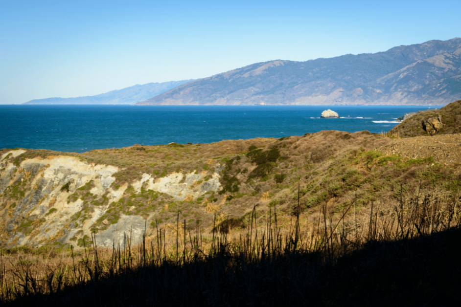
- Location: Big Sur, CA
- Length: 8 miles
- Difficulty: Moderate
- Dog-friendly: no
The Creamery Meadow, Ridge, Panorama and Bluffs Trail Loop is a breath-taking trail located in Andrew Molera State Park in Big Sur, California. Big Sur is a popular State Park in California, located approximately halfway in between San Francisco and San Luis Obispo along the coast.
There is a $10 parking fee that is paid through self-pay in the parking lot near the trailhead.
The hike begins in a forested meadow landscape before quickly turning to a large hill to be climbed. After summitting the hill, you will traverse through forest until you reach the beautiful coastline.
There you will have an opportunity to detour from the hike briefly to explore the beach. Your hike will finish along clay, arid land until you reach the junction to take you back to the trailhead.
This hike is best done in the morning to beat the crowds and also to have a cool breeze while climbing the large hill at the beginning of the hike! I recommend packing snacks and a lunch to enjoy at the beach, as well as ample water for the parts of the hike that are not forested.
There are limited food and lodging options in Big Sur without advance notice, but Carmel is a quick 40 minute drive away and has ample seafood restaurants to enjoy a well-deserved meal at!
As experienced by Jess of Travels and Tannins
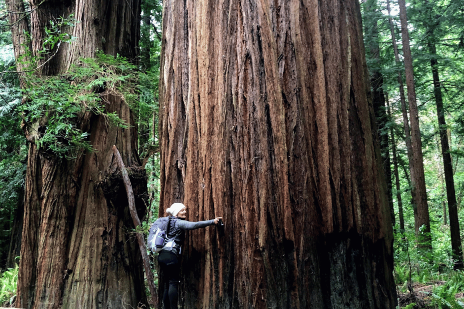
4. Tall Trees Grove
- Location: Prairie Creek Redwoods State Park, McKinleyville, California
- Length: 4.5 miles
- Difficulty: Moderate, 1600 feet elevation gain
- Dog-friendly?: No
Tall Trees Grove is a permit-only 4.5-mile hike located in Prairie Creek Redwoods State Park through ancient old-growth trees. Dogs are not permitted on this trail, though Redwood State and National Parks have many other dog-friendly hikes.
The trail descends into a grove of some of the tallest and oldest redwoods on earth. This includes the Libbey Tree, once the tallest tree in the world. The specific locations of other champion trees are kept secret to protect them. Coastal redwoods can grow to be 250-300 feet tall, and some trees along this trail grow to 350 feet.
This is a remote trail, so you’ll need to pack in your lunch and expect to spend about four hours on the hike, plus travel time. It can also be quite a bit cooler in the groves, as you are shaded by 300 foot trees. Make sure to pack a rain shell and hat.
This trail requires a free permit, since the small parking lot is restricted to 50 groups per day. No other entrance fee is required. Apply for a permit 180 days to a day prior. The emailed permit will contain an access code to the gated road.
The trailhead is seven miles down a dusty road. Longer RVs and trailers are not permitted. The remoteness of the Tall Trees Grove trail and its enormous trees create a serene and other worldly hiking experience, making this all worth it.
As experienced by Laura of Hi Friends It’s Laura
5. Manzanita Lake
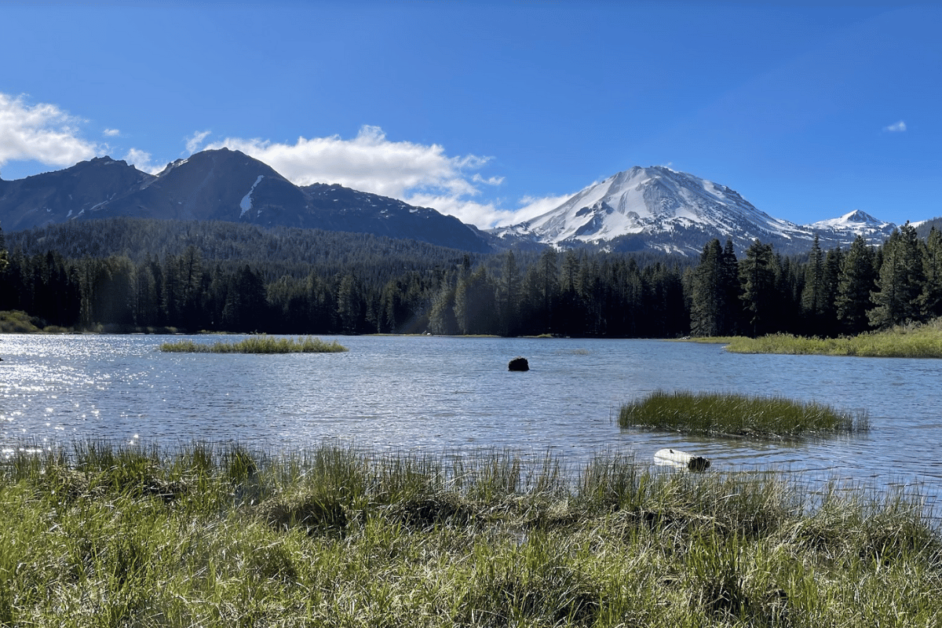
- Location: Manzanita Lake in Lassen Volcanic National Park
- Length: 1.7 miles
- Difficulty: Easy
- Dog-friendly?: No
Manzanita Lake Trail in Lassen Volcanic National Park offers a peaceful and enjoyable experience, especially for families with young children.
While the park has more challenging hikes like the Lassen Peak trail, the hour-long Manzanita Lake Loop provides stunning views and is a leisurely stroll.
This serene hike is a great introduction to Lassen Volcanic National Park. It’s conveniently located at the northwest entrance and offers a picturesque view of the Lassen Peak glaciers and the Chaos Crags domes reflected on the lake about halfway through the hike on the western shore.
There is little elevation change as you meander around the looping dirt trail. Keep your eye out for wildlife, especially black-tailed deer.
There is plenty of parking at the boat launch, and the Loomis Museum and public restrooms are conveniently connected to the trail.
Entrance to Lassen Volcanic National Park is free with your America the Beautiful National, or $30 per vehicle.
If you’re looking for a hike that you can access by vehicle from November through May, the Manzanita Lake Loop trail is a great option. However, it’s important to check the conditions beforehand because roads to the park may be closed during the snow season.
As experienced by Nicholas and Kelsea of Out Of Office Mindset
Best Hiking Trails Near San Francisco
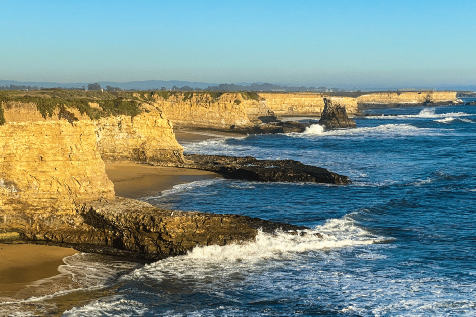
6. Wilder Ranch State Park
- Location: Wilder Ranch State Park, Santa Cruz, California (73 miles from San Francisco)
- Length: 2 to 10 miles
- Difficulty: Easy to moderately challenging
- Dog-friendly? Unfortunately, no dogs are allowed at Wilder Ranch State Park (only service dogs)
With more than 34 miles of trails, Wilder Ranch State Park is one of the best places to take a day hike in California. This historic state park, located off Highway 1 north of Santa Cruz, offers stunning views along the bluffs overlooking the Pacific Ocean. Or take a trail down to one of the secluded, sandy beaches.
For one of the best hikes, start at the parking lot trailhead near the Wilder Ranch State Park entrance. Trail posts eventually direct you to Old Cove Landing or Ohlone Bluff Trail. Take a right and walk down the old railroad tracks. Watch for another Ohlone Bluff Trail post on the left. This grassy path with a gentle incline leads you to breathtaking coastal bluffs with crashing waves.
Out and back to Ohlone Bluff Trail can be as short as 2 to 3 miles. Or you can loop around to create longer hikes up to 10 miles. A 2.5-mile Old Cove Landing – Ohlone Bluff Trail loop takes you to the shoreline.
The 7,000-acre Wilder Ranch State Park also offers some educational opportunities. This living history farm features an 1800s Victorian home, farmhouse, an adobe, and other historic buildings.
Add exploring Wilder Ranch State to your list of best hikes in California. Hiking the park’s multitude of trails is just one of the best things to do in Santa Cruz, California.
As experienced by kmf of kmfiswriting.com
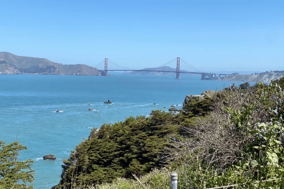
7. Lands End Hike
- Location: San Francisco
- Length: around 3.4 miles
- Difficulty: Moderate
- Dog-friendly? Yes
The Lands End hike in San Francisco is a breathtaking trail that offers stunning coastal views and is a must-do hike in any San Francisco itinerary. Located on the city’s northwest coast, Lands End is a part of the larger Golden Gate National Recreation Area.
Parking is free at the Lands End Lookout parking lot. The hike begins at the Lands End Lookout Visitor Center, where you can learn about the area’s history and pick up maps or informational brochures. From there, the trail winds along the rugged coastline, providing panoramic views of the Pacific Ocean, the Golden Gate Bridge, and the rocky cliffs that define the landscape.
One of the highlights of the hike is the Sutro Baths, the ruins of a once-grand public swimming complex built in the late 19th century.
Continuing on, you’ll reach the Mile Rock Overlook, where you can marvel at the rugged cliffs and the crashing waves below. Further along the trail, you’ll encounter the Lands End Labyrinth, a man-made stone labyrinth that overlooks the ocean. At the end of the trail, you’ll find yourself at Eagle’s Point, a scenic lookout with panoramic views of the Golden Gate Bridge.
The entire Lands End hike is approximately 3.4 miles long, but you can customize the length of your hike by exploring shorter loops or taking detours to the various viewpoints along the way.
As experienced by Anu of Destination Checkoff
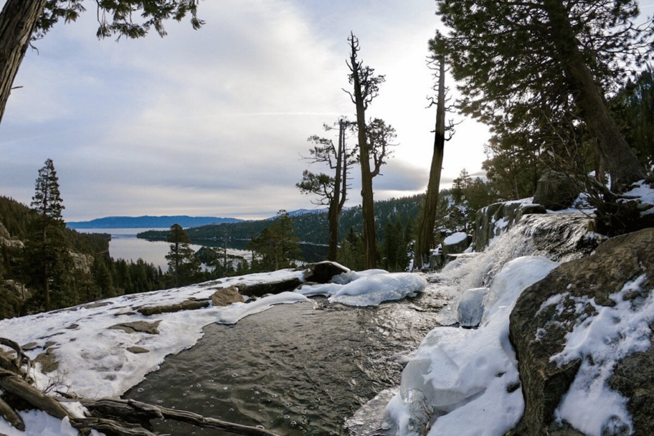
Lake Tahoe Hikes
8. Rubicon Trail
- Location: Lake Tahoe – D.L. Bliss State Park
- Length: 16.4 miles
- Difficulty: Moderate
- Dog-friendly: No
Rubicon Trail is one of the best hikes in California! Located in the beautiful Lake Tahoe area, it is a hike worth experiencing.
Lake Tahoe is huge, it actually takes 3 hours to drive around the entire lake. The Rubicon Trail is one of the longest trails in the area. But don’t worry, you do not have to complete the entire trail to enjoy it.
Because the Rubicon Trail is so long there are lots of parking options. You can park near the Vikingsholm parking area or drive to the D.L. Bliss State Park parking area. I recommend parking in D.L. Bliss State Park because this area of the trail is beautiful!
The Rubicon Trail has bridges, a lighthouse, and an incredible view of Lake Tahoe. If you are starting at D.L. Bliss State Park and want to see the lighthouse, I have a tip for you. There will be a sign to go up to the lighthouse, walk past this you will have another opportunity down the path to get to the lighthouse. It is not as steep as the first turn-off.
The Rubicon Trail is one of the best hikes in Lake Tahoe! Lake Tahoe is an amazing place to visit if you love to trail run or just love hiking. There are some challenging hikes in this area that will push you and keep you wanting more! I highly recommend hiking the Rubicon Trail at Lake Tahoe.
As experienced by Lisa of Planning Away
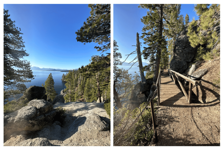
9. Emerald Bay Viewpoint Trail
- Location: Emerald Bay State Park
- Length: 4.4 miles
- Difficulty: Moderate
- Dog-friendly?: Yes
If you’re looking for one of the best day hikes in California then you need to try The Emerald Bay Viewpoint Trail in Emerald Bay State Park.
After all, this moderately difficult hiking trail is home to one of the most iconic viewpoints in the Lake Tahoe area.
Just be aware that you need to pay a $10.00 entrance to get into the park. You also may want to try the Emerald Bay hike in either the spring or fall. This way you can avoid the crowds, while the weather is still pleasantly mild.
Now, to do this hike you’ll start on the Vikingsholm Trail. This path will take you down to the Vikingsholm Mansion and you’ll then take a left at the junction to get on the Rubicon Trail.
Continue along the perimeter of the bay until you hit Emerald Point, where you can enjoy jaw-droppingly beautiful views of Emerald Bay. Feel free to go for a swim too before you head back.
In total, this hike should take between two and four hours to complete, depending on how often you stop.
However, if you are looking for more hikes in the area then you can also do the Rubicon Trail, Vikingsholm Trail, Eagle Falls Trail, and the Emerald Bay Trail.
As experienced by Meg of Fox in the Forest
Southern California Hikes
Day Hikes near Los Angeles, California
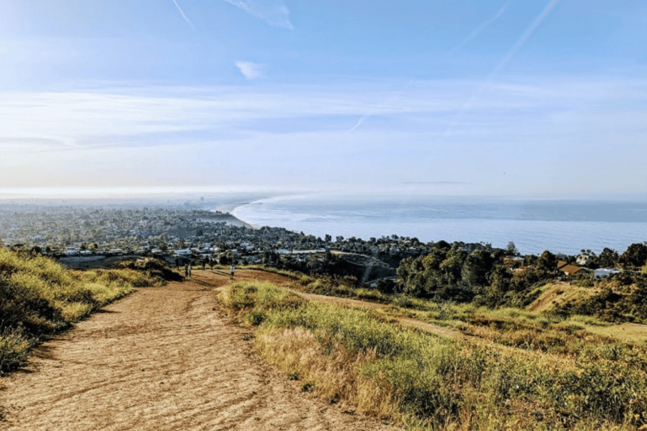
10. Runyon Canyon
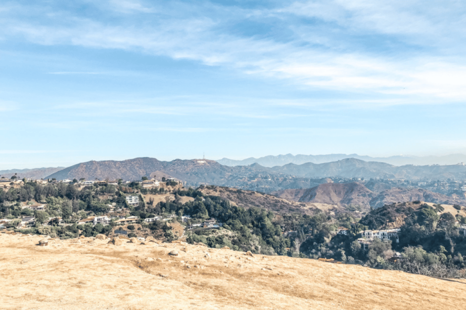
- Location: Los Angeles
- Length: 2.7 loop hike
- Difficulty: Moderate
- Dog-friendly?: Yes
Runyon Canyon is easily one of the best hikes to experience while in Los Angeles. Runyon Canyon Park is located in the Santa Monica Mountains. The trail offers stunning views of the Hollywood Hills and even the Hollywood sign, making it one of the best free things to do in LA!
Runyon Canyon Trail is also known to be a celebrity hot spot to hike as well, so you may even see someone famous on the trail. Runyon Canyon is also very pet-friendly with areas pets can even go off-leash. It’s a definite stop if visiting LA with your pup!
Some tips to know before hiking at Runyon Canyon include bringing water and wearing sunscreen because there is little to no shade. Areas of the hike can have loose gravel, so sneakers are best for this trail, and it is also important to mention there are no restrooms at the park.
The only parking lot for Runyon Canyon has been closed, so you will have to find street parking. There are 3 different entrances to choose from.
After your hike, you can treat yourself to some In-N-Out Burger nearby.
As experienced by Sam of Find Love and Travel
11. Mt. Baldy
Location: Mt Baldy
Length: 11 miles (7 hours round trip)
Difficulty: Difficult
Dog-friendly?: Yes (on leashes)
One of the best day hikes to experience in California is Mt. Baldy.
At 10,064 ft Mt. Baldy is the highest point in LA, and on a clear day, you can see for miles from the summit. Mt Baldy is one of the most popular hikes in the area, so it’s best to start in the early morning on a weekday (ideally) to avoid the crowds.
Parking can be found at Manker Campground, Mt Baldy. (Put this into your GPS and you’ll be directed there). Also note that admission is free, which is a nice plus!
Even with starting this hike at sunrise it’s likely you’ll get caught in the afternoon heat. Make sure to pack plenty of water, sunscreen, and snacks to sustain you through your hike. The temperatures can be cool in the early morning, so consider wearing lightweight layers for warmth in the morning and or protection from the afternoon sun.
Mt Baldy is a must stop for any adventure-lovers visiting LA for a weekend!
Experienced by Chelsea from Adventures of Chels
12. Los Leones
- Location: 510 Los Liones Dr, Pacific Palisades, CA 90272 (Topanga State Park)
- Length: 5 – 8 miles round trip, depending on where you start
- Difficulty: Fairly challenging
- Dog-friendly?: They are only allowed on the Los Leones Day Use Trail
For a scenic and heart-pumping hike in LA, don’t miss Los Leones! The challenging hike starts at the Los Leones Canyon Trailhead just off Los Leones Drive; from there, it is 8 miles round trip. If that’s too long for you, there is a shorter option.
Head to the Paseo Miramar Trailhead, which is tucked back into a neighborhood — at first, it might seem like you’re going the wrong way, but keep going (the trailhead is at the end of a dead-end road). There isn’t a parking lot for the Paseo Miramar Trailhead, but street parking is available (watch out for no parking signs). From here, the hike is about 5 miles round trip and climbs over 500 feet in elevation through the canyon.
The draw for this hike are the panoramic views once you get to the Parker Mesa Overlook. On a clear day, you get beautiful coastal views and can sometimes see Catalina Island. After the hike, head into Santa Monica for a bite to eat. One of the best spots to check out is Margot’s Plant-Based — they have one of the best vegan breakfast menus in LA and are only a few blocks from Santa Monica Beach.
As experienced by Rebecca from Veggies Abroad
13. Top of the World Trail
- Location: Laguna Beach
- Length: 2.5 miles
- Difficulty: Moderate
- Dog-Friendly: Yes
Laguna Beach’s Top of the World trail is an incredible California hike with breathtaking views of the city and stunning coastline. Climb to the top of this popular trail in Alta Laguna Park to marvel at Laguna Beach’s best beaches from the highest point possible.
The hike spans approximately 2.5 miles round trip and is considered moderately difficult. It features a mix of uphill and downhill sections, with some steep inclines, typically a moderate challenge for hikers.
Along the way, you’ll be surrounded by beautiful coastal views of the sparkling ocean and sandy beaches. The highlight of Top of the World hike is the summit. Once you reach the peak, you’ll find sweeping views of Laguna Beach’s best beaches, including Thousand Steps Beach and Crescent Bay.
Admire the turquoise waters, golden sands, and rugged cliffs that make these beaches so picturesque. It’s an ideal spot to soak in the beauty of the coastline and capture stunning photos.
It’s best to use free Laguna Beach public transportation to reach this hike since the trail head is located in a residential area. After your adventure, there are plenty of things to do nearby.
Explore the town’s well-known art scene by visiting the Laguna Art Museum which is home to an impressive collection of California art.
For a unique place to stay, consider The Ranch at Laguna Beach, nestled in a serene canyon with stylish interiors and an on-site golf course. After the hike, you can treat yourself to a delicious meal at The Cliff Restaurant, which offers panoramic ocean views and delicious seafood.
As experienced by Sydney of Sydney to Anywhere
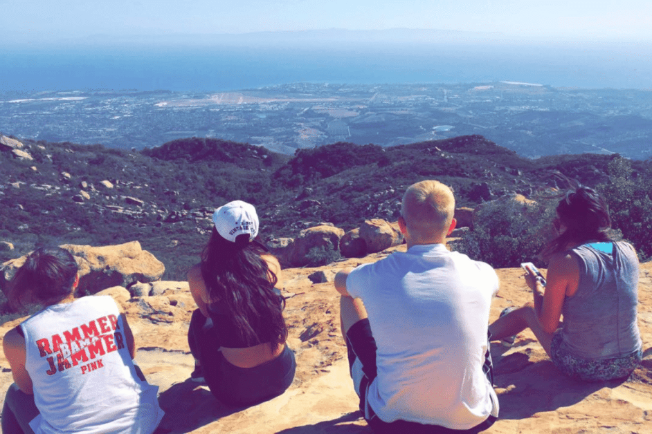
14. Inspiration Point
- Location: Santa Barbara, CA (95 miles from Los Angeles)
- Length: 3.4 miles
- Difficulty: Easy to Moderate
- Dog-friendly?: Yes, on leash
One of the most popular day hikes in Santa Barbara, Inspiration Point, is a must-do hike when exploring the Santa Ynez Mountains.
The trail is a moderate, 3.4-mile out-and-back hike with 935ft of evolution gain, mostly towards the end. As a reward, you will be met with a stunning, panoramic view over the city of Santa Barbara and out to the ocean – on a clear day you can see the Channel Islands!
When you reach the trailhead, there should be street parking (but go early to avoid the crowds and snag a spot). There are multiple trails that begin at the trailhead or branch off from the trail you’re following, but the hike is well-marked so simply continue to follow the signs to Inspiration Point.
Dogs on leash are allowed on the trail and the trail is open year-round but is best in the spring when the weather is mild and the wildflowers are in bloom.
After the hike, make your way back down the mountain and enjoy a hearty meal at one of the delicious restaurants in the area such as Los Agaves, or a refreshing smoothie from Blenders. Maybe take a dip in the ocean to cool off after your hard work!
If you’re looking for somewhere to stay near the trail that won’t break the bank, take a look at the more affordable hotels in Goleta, an adorable town that is home to the Monarch Butterfly Grove, and some of the best places to eat in the area.
As experienced by Janelle of Make The Trip Matter
Want to explore more of Los Angeles? Check out the the LA GoCity Pass to save of 40+ attractions!
Best Hikes in Channel Islands National Park
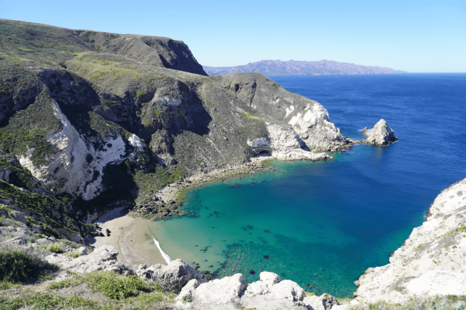
15. Potato Harbor
- Location: Santa Cruz Island, Channel Islands National Park.
- Length: 5 miles round trip with 620 feet of elevation gain.
- Difficulty: Moderate
- Dog-friendly?: No dogs are allowed on the Channel Islands.
Get off the mainland of Southern California and head to Channel Islands National Park for one of the best day hikes in the state. The Channel Islands can only be reached by a ferry ride from Ventura.
You don’t need to pay additional fees to visit other than your ferry ticket. Along the way to the island, you have a good chance of encountering dolphins!
Santa Cruz Island is one of the most accessible islands in the park, and Potato Harbor is one of the best hikes there.
The island is not commercialized, so you will need to bring all your water and food for the day, as well as sunscreen since the trail is fully exposed.
Along the way to Potato Harbor, you’ll see endemic plant and animal species, with wildflowers in the spring. The trail stays along the coast so there are magical ocean views the entire time.
You will probably see the Island Fox while there, a small native fox species. As cute as they are, be sure not to approach or feed them and keep wildlife wild.
When you reach Potato Harbor you’ll be greeted by picturesque views of the harbor below, and maybe spot a seal hanging around on the shores! After your ferry ride back, stop at Brophy Bros. in Ventura for great seafood right on the harbor.
As experienced by Kate of Kate Roams the World
Death Valley Hiking
16. Natural Bridge
- Location: Badwater in Death Valley National Park
- Length: 1-mile round trip
- Difficulty: Easy
- Dog-friendly: You cannot bring pets on this or other trails in the park.
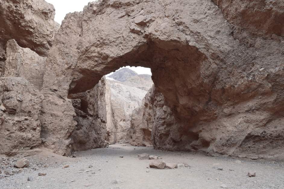
Natural Bridge Trail in Death Valley is an amazing California hike. It takes you via a canyon path to a stunning arch formation.
The national park charges admission fees. The hike is $30 per vehicle or free if you have an Interagency pass.
The trailhead is at the end of the short and unpaved Natural Bridge Road near Badwater. The trail is unmarked but you won’t get lost. There is only one path up the wash canyon.
You will reach the 35-ft high Natural Bridge in about 30 minutes. The canyon continues for a few hundred feet past the bridge. Stop to admire the views of Badwater Basin on your way back.
Death Valley has a reputation for its intense summer temperatures. Take several precautions to make your hike to Natural Bridge more enjoyable.
Start your hike early, ideally before 10 a.m. Wear sturdy hiking shoes, sunscreen, and UV protective clothing. And stay hydrated throughout the hike.
Make sure to visit the nearby Devils Golf Course, Artists Palette, and Mesquite Flat Sand Dunes. Look into Badwater Saloon if you get hungry after visiting the dunes. It is one of the few restaurants and hotels right in the middle of the park.
As experienced by Anastasia of Travel Realist
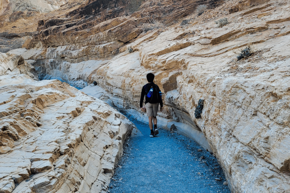
17. Mosaic Canyon Trail
- Location: Death Valley National Park
- Length: 4 miles round trip
- Difficulty: Moderate to Difficult
- Dog-friendly?: No
Mosaic Canyon Trail is a 4-mile round trip out-and-back hike in the heart of Death Valley National Park. The trail is rated as moderate to difficult and takes an average of 2-3 hours to complete. Known for its beautiful marble narrows and colorful canyon walls, the trail is a must-see in the park.
The trailhead is accessed via a 2.3-mile unpaved dirt road located immediately south of Stovepipe Wells village in Death Valley. While this road is passable by the average vehicle, the dirt road is not recommended for RVs. Because of Death Valley’s infamous heat, this hike is best done November – March.
But whatever the season, prepare for the heat by bringing plenty of water, sunscreen, and a hat for the trail.
The marble canyon is near the beginning of the trail, before the hike becomes strenuous. This section of the trail is good for hikers of all ages, and it is a great way to experience the beauty of the canyon without hiking the entire trail. If you do decide to hike the entire trail, look for the rock arrows to guide your way. The trail does not have trail markers.
After hiking, visit the nearby Mesquite Flat Sand Dunes or grab a bite at the Stovepipe Wells Village Saloon. The entrance fee to Death Valley is $30/vehicle. Passes can be purchased at Death Valley’s ranger stations, campsites, and visitor center.
As experienced by Yvonne of MPA Project Travels
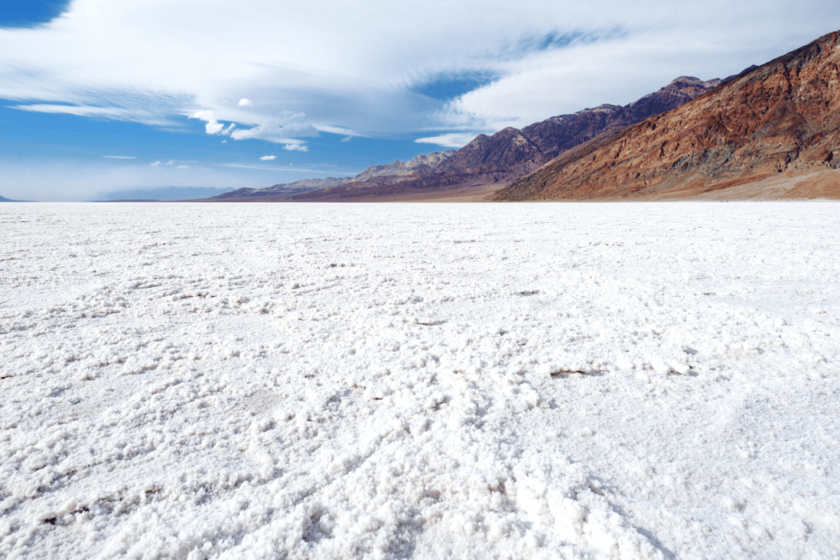
18. Badwater Basin
- Location: Death Valley National Park
- Length: 1.9 miles
- Difficulty: Easy
- Dog-friendly? No
The Badwater Basin Salt Flats trails is one of the most unique day hikes in all of California (maybe even all of the United States. Immediately after stepping foot onto the salt flats, you will feel as though you have landed on a different planet.
There is a large parking lot at the base of the trail, but we also saw people parking on the street when it was full. After leaving the parking lot, you will be able to see the entire trail from your car. Yep, it may be the world’s flattest trail ever.
Even though the hike is short and flat, do not underestimate the Death Valley heat. Still show up prepared with a lot of water and sunscreen! I recommend visiting in January or February to avoid this heat!
The hike will not take you that long, but it’s a must stop during a day in Death Valley! Then you can say that you have visited the lowest point in all of North America.
As experienced by me, Jordan of the Homebody Tourist
Day Hikes in Yosemite
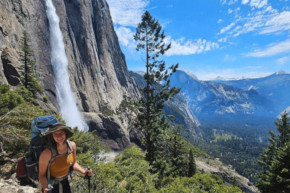
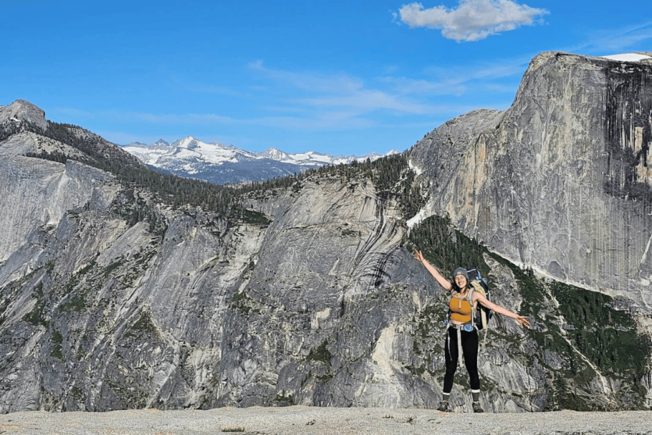
19. Upper Yosemite Falls
- Location: Yosemite National Park
- Length: 6.6 miles
- Difficulty: Hard
- Dog-friendly?: No
Hiking Upper Yosemite Falls is an exhilarating (and challenging) adventure that takes you to some of the very best views in Yosemite National Park.
With a total length of approximately 6.6 miles round trip, this trail offers an intense but immensely rewarding experience for visitors.
As you can see in the picture above, I hiked this trail during a recent backpacking trip (it was our way back down to the valley). But, it is one of the most popular day hikes in the park.
The difficulty level is considered strenuous, as you ascend approximately 2,700 feet in elevation, navigating steep switchbacks and rocky terrain. It’s essential to come prepared with sturdy hiking boots, plenty of water, and snacks (yes to allllllll the snacks) to sustain your energy.
Along the way, you’ll be treated to breathtaking panoramic views of Yosemite Valley, the roaring Yosemite Falls, and the surrounding granite cliffs, making it a must-do hike for adventurers seeking an unforgettable Yosemite experience.
The trailhead is located along the Valley Loop Trail near Camp 4. You can either park across the street at the Yosemite Falls parking lot, or take the park’s shuttle to stop #7.
As experienced by me, Jordan of The Homebody Tourist
20. Mirror Lake
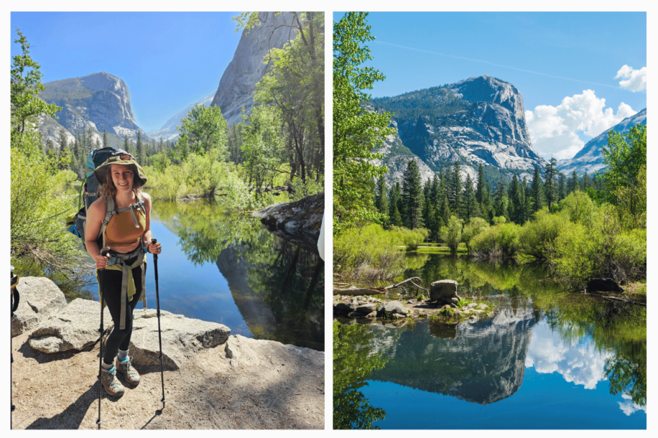
- Location: Yosemite National Park
- Length: 2 miles
- Difficulty: Easy
- Dog-friendly?: No
The trail to Mirror Lake is approximately 2 miles round trip, making it a relatively easy and family-friendly hike suitable for all skill levels.
The path meanders through scenic meadows, lush forests, and alongside the tranquil Merced River. It’s important to note that the lake itself is seasonal, often reflecting the surrounding granite cliffs and majestic Half Dome during the spring and early summer months.
Therefore, planning your visit accordingly can enhance the enchanting experience.
Because it is such a short hike, do expect to share the trail with all the crowds of Yosemite. The nearest parking lot is Curry Village or you can take the shuttle to stop #17!
As experienced by me, Jordan of The Homebody Tourist
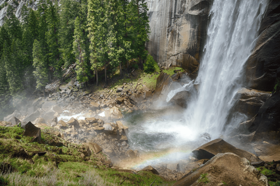
21. Nevada Falls via the Mist and John Muir Trail Loop
- Location: Yosemite National Park
- Length: 6.4 Miles Loop
- Difficulty: Moderate
- Dog-friendly?: No
Nevada Falls via the Mist and John Muir Trail Loop is one of the best day hikes in California because there are so many epic viewpoints along the way. Hikers can enjoy stunning views of Vernal and Nevada Falls, Emerald Pond, and Silver Apron while also getting views of Yosemite Valley.
While the hike is spectacular, there is a significant elevation gain of 2,200 feet. Start hiking early in the day to avoid the crowds. As the day gets later, there can be a backup of people as you climb the stairs toward the top of Vernal Fall, where the stairs can get narrow and slippery.
After making your way up to Vernal Fall, hikers continue past Emerald Pond and Silver Apron to Nevada Fall. The top of Nevada Fall offers incredible views and an excellent place to eat lunch before heading back down. Grab a spot on the other side of the footbridge and relax while enjoying lunch.
We took the John Muir Trail down, which is a little easier given there aren’t any wet slippery rocks to traverse. The John Muir Trail offers hikers another view of the falls and Liberty Cap. However, hikers can make this a shorter out-and-back trail by heading back down the Mist trail.
Reward yourself with dinner at the Ahwahnee Hotel! Just be sure to make a reservation well in advance of your hike.
Since this hike is in Yosemite National Park, you may need to make a park reservation and pay a park entrance fee to access the park. The closest parking lot is in Curry Village (Half Dome Village).
Pro Tips: Bring lots of water and food. Depending on the time of year, prepared to get wet!
As experienced by Michelle Steinhardt of The Trav Nav
22. Half Dome
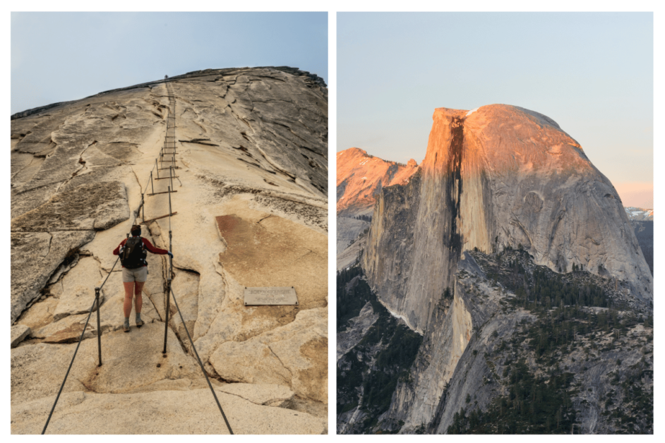
Location: Half Dome Hike, Yosemite National Park, California
Length: 16 miles, 10-12 hours
Difficulty: Difficult and strenuous
Dog-friendly?: No
The Half Dome hike in Yosemite National Park is not for the out of shape or unprepared. With a total elevation gain of 4,800 feet, this hike will take you past the magnificent Vernal and Nevada falls, through Yosemite Valley, and on top of the great Half Dome.
Ultimately, you will be rewarded with panoramic views from the summit, including the majestic Yosemite Falls and the awe-inspiring High Sierra. The most famous, or infamous, part of the hike is the last 400 feet up the cables to the summit of Half Dome.
This portion requires a permit which is won through a lottery system. The lottery opens in March of every year. There is a $10 non-refundable fee to enter the lottery, and each permit won will have a $10/person fee.
In addition, to access Yosemite National Park there’s a $35 entrance fee per vehicle for 7 days, or use the Annual Pass for all US National Parks for $80. It is highly recommended to start the hike early to ensure you have enough time to hike back.
Bring plenty of water to avoid dehydration and be aware of symptoms of altitude sickness. It can also be helpful to bring non-slip gloves to aid with climbing the cables.
After conquering Half Dome, check out some other challenging hikes like the Upper Yosemite Falls hike and Glacier Point hike. These two day hikes also offer breath-taking views and a great workout.
As experienced by Shreya of Where Is Shreya
23. North Dome
Location: Yosemite National Park
Length: 9.2 miles
Difficulty: Hard
Dog-friendly?: No
The North Dome Trail spans approximately 9.2 miles round trip, offering a challenging-level hike that is suitable for intermediate day hikers and backpackers.
As you make your way through the trail, you’ll encounter diverse terrain, including dense forests, open meadows, and rocky slopes.
The highlight of this hike is reaching North Dome itself, a granite formation that provides a spectacular vantage point overlooking the iconic Yosemite Valley, with stunning views of Half Dome and Yosemite Falls in the distance.
The North Dome Trail promises an immersive adventure that showcases the grandeur of Yosemite’s natural wonders, making it a must-do hike for outdoor enthusiasts seeking unforgettable vistas and a sense of accomplishment.
As experienced by me, Jordan of The Homebody Tourist
Day Hikes near San Diego
24. Ho Chi Minh Trail (Saigon Trail)
- Location: La Jolla, California
- Length: 0.4 miles (~0.6 kilometers) one way
- Difficulty: Moderately challenging
- Dog-friendly?: no
The Ho Chi Minh Trail (also known as the Saigon Trail) is located in La Jolla, San Diego. It leads down to Black’s Beach, where you can spend the day swimming, surfing, or tanning on the sand.
Parking is available along the street in the neighborhood by the trailhead, though be sure to read all parking signs. Some areas do have two hour time limits. Moreover, the trail is open to visitors 24/7, and there is no entrance fee.
The trail is 0.4 miles (~0.6 kilometers) one way, and an average hiker can complete it within 20 minutes.
Although short, you will notice almost immediately that this is more of a unique and adventurous trail. For example, there is a wooden plank crossing, a section where you have to maneuver through a ravine, and a rope at the end to help you make the final descent to Black’s Beach
When you are ready to leave, you have two options. You can hike back along the trail or you can walk a bit further down the beach and walk up the service road. The service road is less adventurous but steeper.
After you finish the hike, head to La Jolla Cove to see some seals and sea lions or to find the secret swing or check out some other fun things to do in San Diego!
As experienced by Alaina Thomas of Beyond the Moments
Other Amazing Day Hikes in California
25. Crystal Lake Hike at Mammoth
- Location: Mammoth Lakes, California
- Length: 1.75 one way; out and back hike
- Difficulty: Moderate
- Dog-Friendly: Yes!
The hike to Crystal Lake takes you to one of most scenic places in Mammoth Lakes, an area that abounds in alpine wonders. As you ascend the trail from the parking lot at Lake George, you’re treated to stunning views of the Mammoth basin, with its many lakes and heavy carpet of pines. And look up now and then to catch sight of Crystal Crag, a huge granite monolith.
Though the hike is considered moderate, you may find it veering toward strenuous. It features an 800-foot gain in 1.5 miles, which means that most of the hike to the lake is steep. So, stop often, sit on a handy rock, and take in the panorama below. The trail is mostly shaded, which will help keep you cooler in the summer months.
Once you arrive at Crystal Lake, 10,000 feet up, relax and enjoy the tranquil beauty. The surrounding trees are mirrored in the lake. The air is clean. Munch on snacks or a picnic lunch.
On the descent, those same views of the Mammoth Basin await, so take your time and savor the experience.
Tip: The parking lot at the Lake George day-use area tends to get busy, especially on weekends. Go early in the morning to get a good spot. The trail will likely be less crowded then, too.
As experienced by Sharon of Exploring Our World
26. Desert View Trail
- Location: Mount San Jacinto State Park, CA
- Distance: 1.5 miles
- Difficulty: easy
- Dog friendly: no
The Desert View Trail is a refreshingly cool escape from the heat of summer. It’s accessible only by taking the Palm Springs Aerial Tramway, an incredible adventure by itself.
A ~$30 fee is required to reach the trailhead by tram, which turns 360 degrees the entire time that so you are always in the right spot to see something amazing.
While there are many wonderful trails at the top, the Desert View Trail is an absolute must do. Less than two miles long, it doesn’t even seem like exercise as there are so many unique distractions. Birds, lizards, butterflies, rock faces for climbing, boulders for sitting, shade for picnicking, and many downed trees with some serious character. Five notches, or lookouts, and different angles of a stunning view at each one.
The best part of this hike, other than the spectacular views, are the trees. The Jeffrey pine emits an aroma similar to butterscotch. You’ll find yourself stopping every few feet just to get up close and personal with the trees. The older the tree, the stronger the smell and some of them you can smell just as you walk by. It really doesn’t get much better. Or more peaceful.
As experienced by Tammi of Wander Healthy
27. Cypress Grove Trail
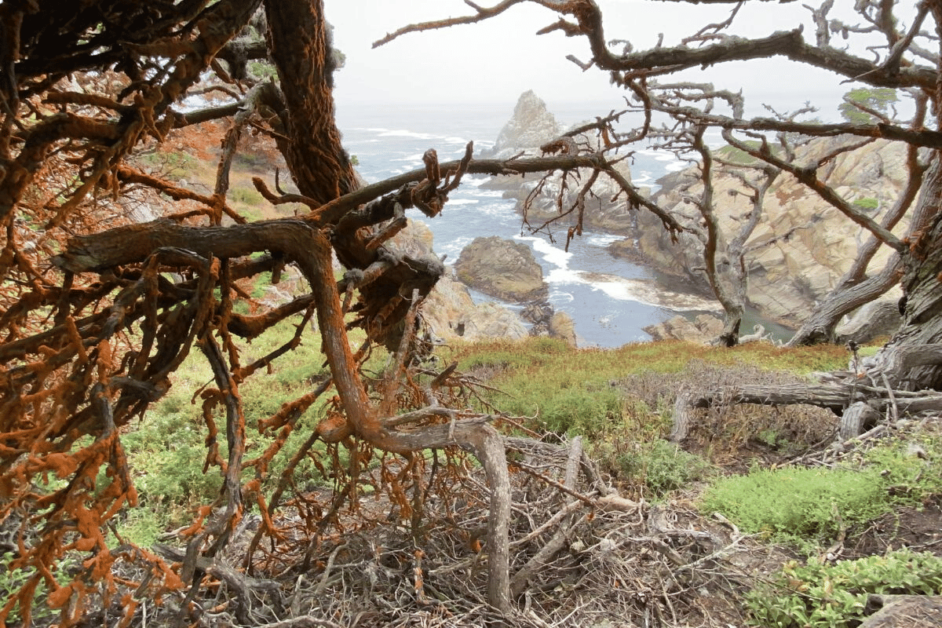
- Location: Point Lobos State Natural Reserve, Carmel-by-the-Sea
- Length: 0.8 miles
- Difficulty: Easy
- Dog-friendly?: No
If you’re looking for a stunning day hike in the “crown jewel of California’s state park system,” look no further than the Cypress Grove Trail at Point Lobos State Natural Reserve.
This trail leads through one of only two wild groves of Monterey cypress trees remaining on Earth. The Point Lobos Reserve was founded to protect these very trees.
In addition to experiencing the wild Cypress grove, hikers are awarded with dramatic ocean views throughout most of the loop. Explore each little detour and viewpoint open to visitors. This trail’s dramatic landscapes create an otherworldly effect you won’t soon forget.
If you still have time to explore after your hike, continue along the South Shore Trail to the Weston Beach tide pools. Inspect the fascinating wildlife at your feet or join the crowds searching the horizon for signs of whales migrating nearby.
Navigating the Cypress Grove Trail is an unforgettable experience for the whole family. Though there are inclines and steps, it can be enjoyed by all ages looking to experience gorgeous natural wonders at the entrance to Big Sur.
As experienced by Kris of JJ & The Bug
28. Moro Rock
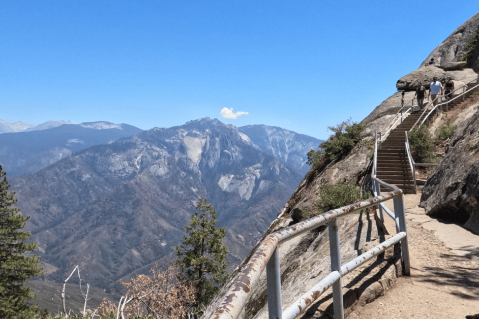
- Location: Sequoia National Park
- Length: 0.5 mile
- Difficulty: Moderate
- Dog-friendly: no
If you’re looking for the best California day hikes, then you’ll love Moro Rock in Sequoia National Park! The Sierra Nevada Mountains really put on a show for hikers who dare this short but steep climb to the top of this massive granite rock.
Located in the Crescent Meadow region of Sequoia National Park, Moro Rock is a short but popular hike for park visitors.
You’ll climb 350 steps to reach the top of the rock. Be sure to watch young kids and hold onto the railing – it’s quite steep and has large drop-offs. The views at the top are breathtaking! With 360-degrees of the Sierra Nevada Mountains, this hike is worth the effort, and a must-see while on a Sequoia National Park visit!
Note that during the weekends and holidays in the summer, you’ll need to take a free park shuttle to access the trailhead. Sequoia National Park charges an entrance fee of $35 per vehicle. Of course, if you have the America the Beautiful pass you’ll get into the park under that pass.
Visitors should book nearby accommodations weeks or months in advance depending on preferences, as they do fill up quickly. Inside the park, Lodgepole Campground is in the middle of the action for tent camping and for RVs, Sequoia Resort and RV Park is nearby. For a hotel, try the budget-friendly Best Western Exeter Inn & Suites in Visalia.
As experienced by Nikki of Inspired Routes
29. Cholla Cactus Garden
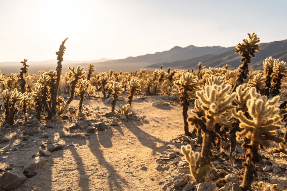
- Location: Joshua Tree National Park
- Length: 0.3 miles
- Difficulty: Easy
- Dog-friendly?: No
Cholla Cactus Garden in Joshua Tree National Park is one of the best easy day hikes in California! It is a must-see on any Joshua Tree National Park road trip.
To enter the park you will need to pay $30 per vehicle for one week of entrance or use an Annual National Park Pass.
Cholla Cactus Garden is unique in the park. Most hikes in Joshua Tree go through the Joshua Trees themselves or to various rock formations around the park. This is one of the few hikes that are not focused on the Joshua Trees.
The best time to visit Cholla Cactus Garden is at sunrise! At sunrise, the early morning light reflects off the cacti’s spines giving them the appearance of “glowing”. This is a short and quick hike, but make sure not to step too close to any of the cacti as they are spikey and can go through clothing.
Afterward, head to one of the other day hikes in Joshua Tree. Some of the best include Arch Rock, Barker Dam, and Hidden Valley.
As experienced by Val of VoyageswithVal
30. Mobius Arch Loop Trail
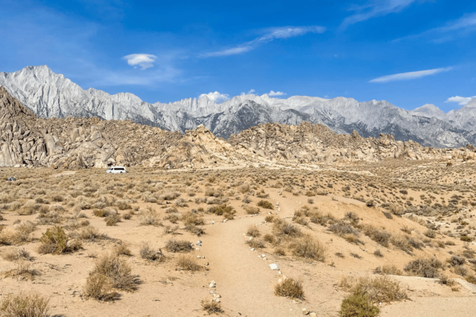
- Location: Alabama Hills National Scenic Area, Lone Pine
- Length: 0.6 mile
- Difficulty: Easy
- Dog-friendly?: Allowed, on leash
If you want to do a cool easy day hike in Southern California, consider the Mobius Arch Loop Trail in the Alabama Hills!
You can hike the loop in either direction, but hiking it clockwise will bring you to Mobius Arch, the star attraction, a lot quicker. If you are crunched for time, you can snap photos at the arch and retrace your steps instead of doing the full loop.
Whichever way you choose, you’ll first get down into the wash, and then stroll the trail, stopping to admire beautiful rock formations along the way. The trail also offers stunning views of the majestic Sierra Nevada mountains.
Mobius Arch is a natural arch that you can climb for photos. The arch perfectly frames the mountain peaks!
Other arches you can see from (or near) the main trail are Heart Arch and Lathe Arch.
After your hike, drive into the little town of Lone Pine for lunch at the Alabama Hills Cafe & Bakery!
As experienced by Dhara of Roadtripping California
Whether you seek breathtaking vistas, serene lakes, or captivating wildlife encounters, these day hikes in California offer a chance to disconnect from the hustle and bustle of daily life. So, lace up your hiking boots, grab your day hiking essentials, and get ready to embark on unforgettable journeys through the enchanting trails of the Golden State.
What other California day hikes would you add to this list? I’d love to hear them over on Instagram!!
")

Comments Off on 31 Breathtaking California Day Hikes