")
")
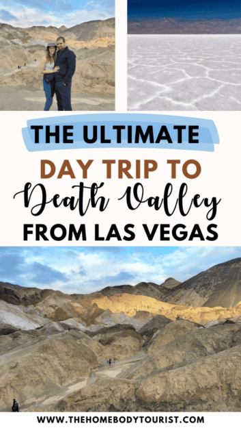
One Day in Death Valley National Park (Day Trip from Las Vegas)
Death Valley is the largest national park in the lower 48, home to SO many unique natural wonders, AND only 2 hours from the neon lights of Las Vegas. Although you could of course spend much longer than one day exploring this massive park, I have put together the ULTIMATE one-day itinerary for those of you who are short on time or PTO. This one day in Death Valley National Park is the PERFECT day trip from Las Vegas. Happy exploring!
This site contains affiliate links to products. I may receive a commission for purchases made through these links at no extra cost to you. There are only products included that I truly love. I APPRECIATE your support!
Table of Contents
Where is Death Valley
Death Valley lies along the border of California and Nevada. The closest airport (by far) is the McCarran International (Las Vegas). It’s about 118 miles away from the Furnace Creek Entrance and takes just over 2 hours. If you didn’t want to start from Las Vegas, you could also fly to LAX (Los Angeles) which is about 5 hours away, or San Diego which is closer to a 6-hour drive.
There are several guided day tours from Vegas that you could join, but I reccommend renting a car so you can explore the park at your own pace.
Death Valley Quick Facts
- Entrance Fees: 30 dollars per vehicle or free with Interagency Annual Pass (80 dollars)
- Hours: 24 hours a day/365 days a year (Visitor Center 8am-5pm)
- Closest Airports: Las Vegas (118 miles), LAX (274 miles), San Diego (354 miles)
- Acreage: 3.2 million acres
- Wildlife? Desert Tortoise, bighorn sheep, coyotes, burros
- Dogs Allowed? Only where your car can go- They are not allowed on any trails.
Best Time to Visit Death Valley
Not summertime.
But in all seriousness, Death Valley is known as the hottest place on EARTH. So unless you are a cold-blooded reptile, I would avoid visiting between the months of May-Septemeber. With this being said, the best time to visit would be between late October-March. We visited in January and were met with cloudy skies and a bit of rain…but I’ll take that over 116 degrees!
Death Valley Average Temperatures by Month:
- January: 67/40
- February: 73/46
- March: 82/55
- April: 90/62
- May: 100/73
- June: 110/81
- July: 116/88
- August: 115/86
- September: 106/76
- October: 93/61
- November: 77/48
- December: 65/38
One Day In Death Valley Itinerary (Day Trip from Las Vegas)
Stop 1: Sunrise at Mesquite Flat Sand Dunes
Distance from Furnace Creek Visitor Center: 23 miles
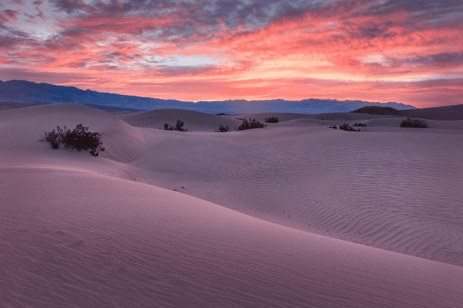
Okaaay, I’ll be honest here and admit that we didn’t make it here for sunrise (we suck at waking up early), buuuut I’ve heard its the best spot in the park to watch the morning sun. Since you’ll be one of the first ones here, you’ll get to see the dunes smooth and undisturbed (except for the occasional coyote or fox track).
Anyways, the Mesquite Flat Sand Dunes cover a large area with the highest dune (known as the Star Dune) reaching over 100 ft. To get to the top of the Star Dune, it’ll be about a 2-mile round-trip hike. It’s not a marked trail, instead, you let your feet guide you to the tallest dune.
There are bathrooms in the parking lot and hiking is NOT advised here after 10 am in the summer months. There is absolutely no shade and the sand gets extremely hot.
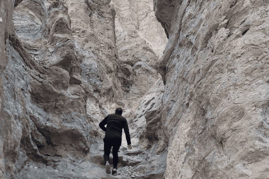
Stop 2: Mosaic Canyon Trail
Distance from stop 1: 3.6 miles
After watching the sunrise, head to your next stop just 5 minutes away. Mosaic Canyon Trailhead is at the end of a 2.5-bumpy dirt road. We were thankful to have a 4-wheel drive car, but we did see many smaller vehicles making the trek.
The trail itself is around 3.3 miles and pretty easy until about 1.3 miles in where the rock scrambling begins. If you are short on time, you will see the namesake mosaic canyon (a curvy small slot canyon) pretty early on in the hike so you do not have to finish the entire 3.3 miles. The trail ends at a dried 20ft waterfall.
Stop 3: Lunch at Stovepipe Wells
Distance from Stop 2: 1.6 miles
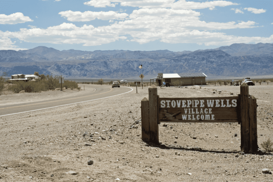
You’ve likely worked up an appetite at this point, so you can stop at Stovepipe Wells Saloon for lunch. If you do not have time to sit down and eat, you can order a box lunch upon request. When we visited, the service was quick, the food was delicious, and it was actually quite affordable (even though it’s one of the only places to eat in the National Park).
There is also a gas station here if you forgot to fill up outside the park. Be ready to pay a hefty fee for it though.
Stop 4: Badwater Basin
Distance from Stop 3: 40 miles
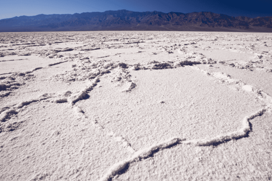
Badwater Basin is the lowest point in all of North America at 282 feet BELOW sea level! After arriving you will see the salt flats in the distance and they will look much closer than they actually are! From the parking lot, it’s about a 1-mile walk to the hexagons. It’s of course an easy flat walk, but we kept joking that we felt like it was a mirage that we were never getting to.
Stop 5: Natural Bridge Trail
Distance from Stop 4: .5 miles
Right down the road from the salt flats is another quick and unique hike. (If you do not have time, you could skip this stop)
Natural Bridge trail is a 1-mile round trip hike to a natural bridge formation (clever name right?). It is located at the end of another dirt road that does occasionally wash out with heavy rains.
Stop 6: Devil’s Golfcourse
Distance from stop 5: 2 miles
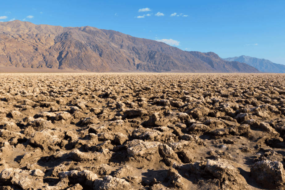
Devils Golfcourse is a stark and dramatic landscape of jagged rocks and salt crystals that is both awe-inspiring and a bit eerie. The saltpan was created when a lake in the valley dried up, leaving behind a large salt flat. It’s a great place to explore and take photos, but watch your step because a fall could definitely do some damage.
Stop 7: Artists Drive
Distance from Stop 6: 7.4 miles (To Artist Palette Overlook)
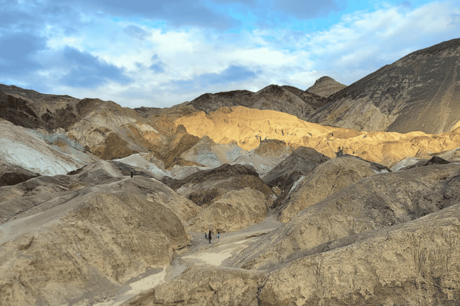
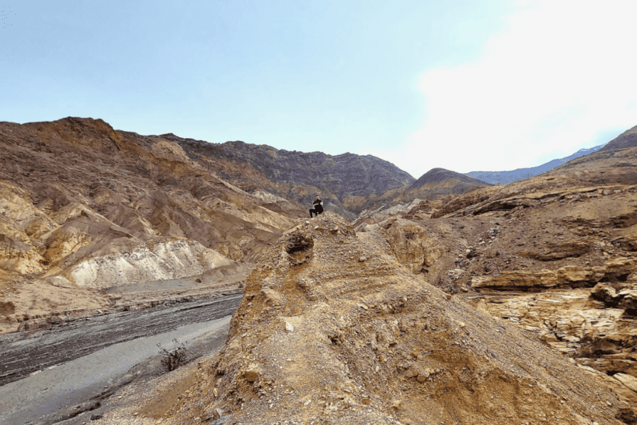
Artist Drive is a scenic 9-mile loop through the colorful badlands. This may have been my favorite stop during our day in Death Valley! It’s a one-way road so you are able to enjoy the views without having to worry about incoming traffic. There are several spots where you can get out for short walks and better views. The most popular stop along this road is of course Artist Palette where you can admire the views from the overlook or walk down into the colorful hills.
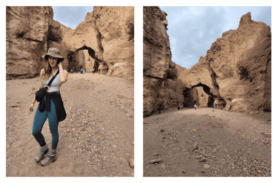
Stop 8: Golden Canyon
Distance from stop 7: 11 miles
Golden Canyon is a 2.7-mile hike through well…a golden canyon…
We didn’t have time to hike the whole trail, but we did find a sketchy side trail that we hiked (straight) up. It wasn’t my idea and I probably wouldn’t do it again, but it did lead to some cool views (I’m a scaredy cat though).
If you do have extra time, you could combine this hike with Gower Gulch and the Zabriskie Point which would make it a 6-mile loop.
Stop 9: Sunset at Zabriskie Point
Distance from stop 8: 5.7 miles
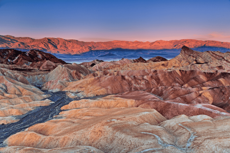
Finally, your eventful day ends with the sunset at Zabriske Point. You can get to the overlook/viewpoint with a quick 1/4 mile stroll up a paved trail. There are also trails down below if you have more time to explore.
Once again, we were there on a very cloudy day so our sunset was non-existent (see below), but beautiful views nonetheless. It’s also one of the most popular spots in the park for sunrise so you could reverse this whole itinerary if you choose (sunrise here, sunset at Mesquite Flat Sand Dunes).
One Day In Death Valley From Las Vegas Map
***I choose to start this day trip from the furthest away stop and then work our way back towards the entrance. You could reverse it if you choose.
Death Valley Day Trip from Vegas Recap:
- Stop 1: Mesquite Flat Sand Dunes
- Stop 2: Mosaic Canyon Trail
- Stop 3: Stovepipe Wells Saloon for Lunch
- Stop 4: Badwater Basin
- Stop 5: Natural Bridge Trail
- Stop 6: Devils Golfcourse
- Stop 7: Artist Drive
- Stop 8: Golden Canyon Trail
- Stop 9: Zabriske Point
Tips to know BEFORE visiting Death Valley
- Fill your gas tank before entering the park. There are gas stations inside the park, but you will pay much more for it.
- There are 3 gas stations in the park in case you forgot to fill up (Furnace Creek, Stovepipe Wells, Panamint Springs)
- Bring snacks! You can get lunch at Stovepipe Wells, but the rest of the day you’re on your own.
- Make sure you bring plenty of water.
- It gets really hot. Visit in the winter months
- When visiting in the winter, dress in layers because as soon as the sun comes out it will get hot.
- Download your map and route beforehand as there is no service in the park.
- Leave your pup at home as they’re not allowed on ANY of the trails.
- If you have more than one day, it would make for an excellent weekend getaway from Las Vegas.
")

Comments Off on One Day in Death Valley National Park (Day Trip from Las Vegas)