Breathtaking USA Road Trips to Take this Fall (2023!)
If you know me at all, you know I LOVE a good road trip. I love the slower pace of life, the opportunity to completely control the itinerary, AND the fact that you can bring your dog!
Each season brings different sights and things to do, BUT autumn brings BEAUTIFUL fall colors and cooler weather for all the outdoor activities. I reached out to the experts to share their favorite USA road trips to take this fall. I’m SO excited to share this epic list of road trips. The pictures alone will make you want to explore the entire United States this Fall!

This site contains affiliate links to products. I may receive a commission for purchases made through these links at no extra cost to you. There are only products included that I truly love. I APPRECIATE your support!
Table of Contents
Fall Road Trips to take on the East Coast
Kancamagus Highway
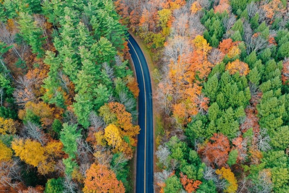
- How many days do you need? 2-3 days
- Starting Point: Lincoln, NH (closest airports LEB-65 miles away or).
- Total miles once at starting point: 35 miles (+ to and from airport and any extra stops)
- When is peak fall foliage? First two weeks of October
The extraordinarily spectacular Kancamagus Highway in New Hampshire has to be regarded as one of the very best US road trips to take in Fall.
At just 35 miles in length from Lincoln to Conway, ‘The Kanc’ might sound alarmingly short for a road trip, but what it packs into that 35 miles is nothing short of a Fall foliage wonderland.
You could simply drive the Kancamagus Highway without stopping in less than one hour, but then you’d miss all the fun. Instead, spend at least one full day, if not two exploring every trail, every waterfall, and every staggeringly beautiful overlook.
In the first two weeks of October, you can expect to see the most vibrant and radiant peak Fall colors in all of New England as you slowly drive between scenic White Mountain National Forest vistas. Soak up endless miles of rolling hills blanketed in fiery reds, burnt oranges, golden yellows, and emerald greens.
If you have a drone, this is the place to fly. No drone? No problem, just don’t forget spare batteries for your camera, you’re going to need them!
Hike to Sabbaday Falls and Champney Falls for waterfall action, photograph the picturesque Russell-Colbath barn, and don’t miss the gorgeous Albany Covered Bridge spanning the Swift River.
Before and after driving the awesome Kancamagus Highway, spend time exploring Franconia Notch State Park to the West and Mt Washington to the East. The Kancamagus Highway is incredibly popular at the start of October, so plan ahead and book accommodation early.
Sample Kancamagus Highway Fall Road Trip Itinerary (From LEB airport):
Day 1:
- Morning: Arrive at LEB Municipal airport and drive to Franconia Notch State Park
- Afternoon: Hike The Flume Gorge Trail (2.2 miles)
- Evening: Ride the Cannon Mountain Aerial Tram (Before 5 pm until October 17th). Grab dinner and a hotel near Lincoln, NH (starting point for tomorrow).
Day 2:
- Morning: Drive to Lincoln, NH and begin your drive down the Kancamagus Highway
- Afternoon: Hike Sabbaday Falls (.7 miles) and Champney Falls (3.1 miles). Make sure to make a pit stop at the Russell-Colbath Barn in between the two hikes!
- Evening: Albany Covered Bridge and check in to stay in Conway, NH
Day 3:
- Morning: Drive to Mount Washington (35 miles, but it’s a curvy drive to make sure to allot for over 1 hour of driving)
- Afternoon: Ride the Mount Washington Cog Railway (3-hour ride) or take a hike in the State Park.
- Evening: Drive back towards the airport for a flight back home (105 miles)
As experienced by Mark and Kristen from Where Are Those Morgans
Lower Delaware River
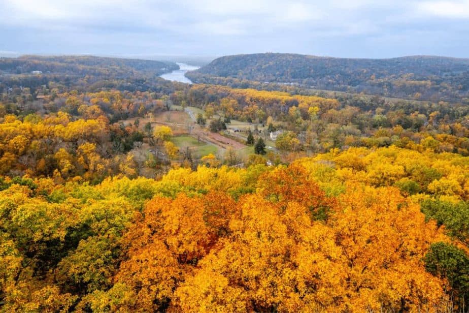
- How many days do you need? 2 or 3 days
- Starting Point: Trenton, NJ (closest airport: PHL-35 miles or EWR- 45 miles)
- Total miles: Approximately 75 miles (+to and from airport)
- When is peak fall foliage? Mid- to late-October
One of the best fall road trips is along the Lower Delaware River. This is the largest free-flowing river in the United States and is recognized as a National Wild and Scenic River, which forms the border between Pennsylvania and New Jersey.
While not particularly long, the drive along the Lower Delaware River is the best place to see fall foliage near Philadelphia and New Jersey. Start in Trenton, NJ, and drive north on the New Jersey side along Route 29. Stopping in Washington Crossing State Park to see the famous site where George Washington led the troops in a mid-winter ambush.
Continuing north, stop in the quaint small towns of Lambertville, Stockton, Frenchtown, and Milford while exploring their antique stores, artisanal food markets, and the beautiful river views. In the afternoon, make your way up to Milford Bluffs for incredible river views at sunset. The town of Milford or Frenchtown make a good place for the night with several B&Bs in each town, and The Milford House makes a historic and unique option for dinner.
The next morning, cross into Pennsylvania and walk in the cool autumn air at Ringing Rocks Park, before following PA Route 32 south. This is the famous River Road. Head south stopping off several notable wineries, including Sand Castle Winery.
In the afternoon, explore historic New Hope, Pennsylvania – the jewel of Bucks County. Around sunset, arrive at Bowman’s Hill Wildflower Preserve to climb the stairs of Bowman’s Tower. From here, there are stunning views of the entire Delaware Valley. If you time your visit right, the autumn leaves glow yellow and red with the sunset. If you can squeeze a third day into your trip spend the night in New Hope and then spend the next day hiking along the Delaware Canal Trail.
Sample Lower Deleware River Road Trip Itinerary
Day 1:
- Morning: Arrive in Trenton, NJ
- Afternoon: Take a hike in Washington Crossing State Park
- Evening: Milford Bluffs for sunset and find a stay in Milford or Frenchtown
Day 2:
- Morning: Ringing Rocks Park
- Afternoon: Wine taste at Sand Castle Winery
- Evening: Bowman’s Hill Wildlflower Preserve for sunset- Spend the night in New Hope
Day 3:
- Morning: Hike or bike some of the Delaware Canal Trail
- Afternoon:
- Evening: Head back towards the airport
As experienced by Lance and Laura Longwell from Guide to Philly.
Booking.comSkyline Drive, Shenandoah National Park
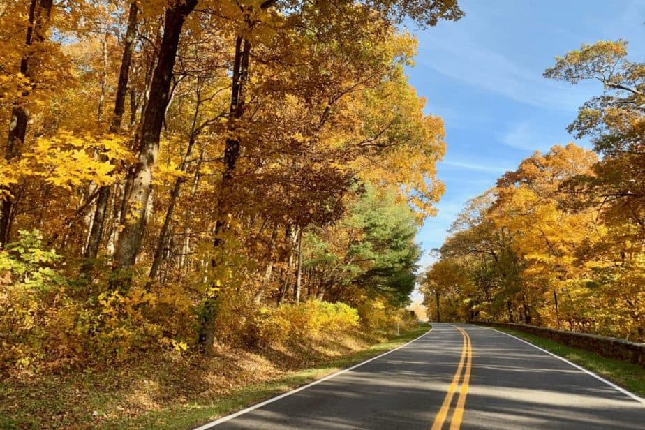
- How many days do you need? 2-4 days
- Starting Point: Front Royal Entrance (Closest Airport IAD)
- Total miles: 105 miles (+ to and from airport + extra days)
- When is peak fall foliage? Early to Mid October
One of the most beautiful fall road trips in the eastern U.S. follows the spine of Virginia’s Blue Ridge Mountains through Shenandoah National Park. Travel the Skyline Drive in the fall to enjoy gorgeous views, hiking trails, and classic lodges where visitors can dine and stay.
Skyline Drive is 105 miles long, so it is possible to complete the drive in a single day. But you will have a much better experience if you spend a few nights in or near the park. Breaking up the drive over two to four days allows time to explore, hike, and relax.
Foliage season on Skyline Drive begins in early October and continues throughout the month. Foliage emerges first at higher elevations then progresses down to the foothills and valleys. Gold and russet colors dominate the view, with bright splashes of red and yellow in the mix.
Allow time to stop at overlooks on each side of the drive so you can enjoy both eastward and westward views. There are 500 miles of trails many leading to summits with great views like Stony Man, Hawksbill, and Mary’s Rock. When you’re ready for a break, visit the park’s two lodges—Skyland and Big Meadows for meals, shops, and a cozy spot to spend the night. And stop in the Byrd Visitor Center to learn about the fascinating geology and human history of beautiful Skyline Drive.
Sample Skyline Drive Road Trip Itinerary
Day 1:
- Morning: Arrive at the Front Royal Entrance and start driving south along Skyline Drive making sure to stop at some of the 75 view points.
- Afternoon: Stop at Skyland for lunch in the lodge, then hike to Stony Man Summit.
- Evening: Hike Dark Hallow Falls Trail (1.4 miles) and head to Big Meadows Lodge for an overnight stay.
Day 2:
- Morning: Sunrise hike up Bearfence Mountain (1 mile) or Hawksbill Loop hike (2.7 miles). Or chase some waterfalls on the Lewis Falls Loop or Dark Hollow Falls trails.
- Afternoon: Visit Byrd Visitor Center to learn about the park then continue the drive south. Stop for the 1-mile rock scramble hike to Bearfence Mountain if you didn’t do it earlier.
- Evening: Finish the rest of the Skyline Drive and arrive in Luray for a place to sleep.
Day 3:
- Morning: Tour the Luray Caverns
- Afternoon: Try out the ropes course onsite at the Luray Caverns
- Evening: Head back to the airport.
by Julie McCool from Fun in Fairfax VA
Join the Homebody Tourist club! Sign up for my newsletter (and grab this FREE TRAVEL PLANNER) to be the first to know about new posts and any exciting news/hidden gems in the road trip world.
Blue Ridge Parkway (North Carolina)
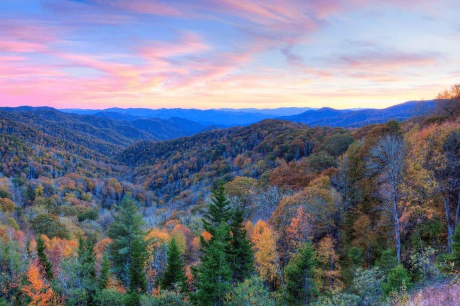
- How Many Days do you need? 2-3 days
- Starting Point: Asheville, NC
- Total Miles: 90 miles
- Peak Fall Foliage: Mid to late October
Blue Ridge Parkway is a scenic 469-mile road spanning between Virginia and North Carolina counties. It is one of the most romantic getaways for couples in the US and a great USA road trip to take this Fall. This particular starts in Asheville heads into the Nantahala forest and ends near Altapass. This section takes about two hours to complete if driving straight through. BUT, you should definitely take time to explore within two to three days.
Peak fall foliage falls between mid to end of October. Blue Ridge Parkway has a variety of elevations, with hundreds of miles of hiking trails, waterfalls, and picnic spots.
If you fly into Asheville, spend your first day exploring the city. You can tour the famous Biltmore Estate, check out the Pinball Museum or the beautiful North Carolina Arboretum. Once nighttime rolls around, be sure to take a walking ghost tour of downtown!
After checking out the city and getting a good night’s rest, head out on the road. Make sure to stop and admire Looking Glass Falls – a rare roadside waterfall and photo opp spot and hike the Moore Cove Falls Trail (1.4 miles)
Stop for lunch at Pisgah Inn. It’s highly recommended that you pre-book a table as everyone is vying for a window table view at 5,000 feet elevation.
The next day, head east of Asheville to pick apples, buy jams, and take a hayride at Orchard at Altapass. Stop at Richland Balsam for the best views of fall colors – at an elevation of 6,053, it is the highest point on the Blue Ridge Parkway and one of the best places to see fall foliage in the US and wildflowers in summer.
Blue Ridge Parkway Sample Itinerary
Day 1:
- Morning: Arrive in Asheville
- Afternoon: Tour the Biltmore house and gardens
- Evening: Asheville walking and ghost tour & find a stay in Asheville
Day 2:
- Morning: Start your drive with stops at Looking Glass Falls and hike Moore Cove Falls Trail (1.4 miles).
- Afternoon: Lunch at Pisgah Inn (make sure to make a reservation!)
- Evening: Watch the sunset at Fryingpan Mountain Tower (1.5 mile) & head back to Asheville for the night
Day 3:
- Morning: Sunrise hike to Chimney Rock
- Afternoon: Pick apples at Orchard at Altapass
- Evening: Head back towards the airport
Tip! Have extra time? Combine this trip with dog-friendly stops in Helen, GA, and Chattanooga, TN!
As experienced by Julie from Wandering Sunsets
USA Fall Road Trips to Take in the West
Yellowstone National Park to Glacier National Park
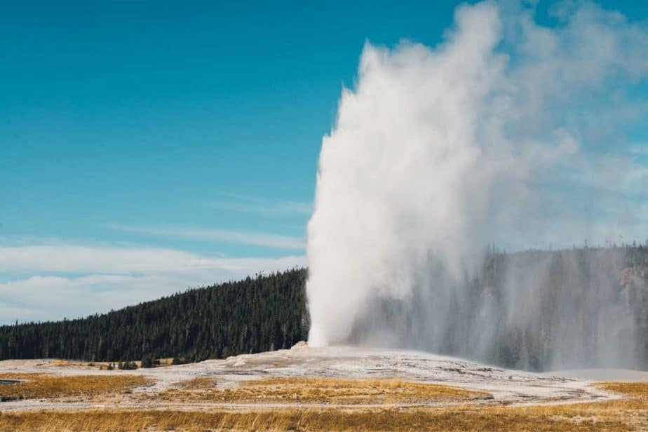
- How many days do you need? 4-5
- Starting Point: Yellowstone National Park
- Total miles: 605 miles (+ to and from airports)
- When is peak fall foliage? Mid to End September
One of the best USA road trips to take in the Fall and it starts and ends at two of the most beautiful National Parks.
This fall road trip starts in Wyoming at Yellowstone National Park to Montana at Glacier National Park. There are tons of amazing stops along the way and most of which is a Montana road trip since only Yellowstone is in Wyoming and the rest of the stops are all in Montana.
This is a popular route among travelers especially in the fall because of the comfortable weather not only around the hot springs and geysers of Yellowstone but also the comfortable, cool mountain air along the way and at Glacier National Park not to mention you’re missing out on the hoards of summer crowds by coming on the shoulder season.
If you plan on enjoying the scenic, Going-to-the-Sun Road in Glacier National Park keep in mind that this road closes typically in mid-October so it’s best to plan an early fall road trip to make sure you get to include this! If that’s not possible, don’t worry there are still many incredible spots at Glacier National Park open from mid-October through the rest of fall.
The same goes for a few roads in Yellowstone, but most roads are open.
This road trip can take as little as one day to multiple days depending on how many stops you plan to take.
Start your road trip in West Yellowstone and plan at least a full day to explore Yellowstone National Park if not more. We recommend taking a slight detour off the direct route to spend at least a night in a cabin at Big Sky and booking an activity like horseback riding through the mountains. Continue to one of the most colorful western towns at Livingston where you can also easily enjoy a night at, don’t forget your camera for the colorful vintage neon signs that are abundant here! Other great overnight stops include Missoula, Kalispell, or Whitefish before arriving at Glacier National Park where you at least need another full day of exploring.
Yellowstone to Glacier Sample Fall Itinerary:
Day 1:
- Morning: Arrive in Yellowstone and follow this Yellowstone West Entrance loop itinerary to see the best sights in the park! This will take you all day!
- Afternoon:
- Evening: Check in to a cabin in Big Sky
Day 2:
- Morning: Horseback ride with Cache Creek Outfitters. They even have a unique horseback riding/fly fishing combo!
- Afternoon:
- Evening: Explore Livingston and grab a cute airbnb here!
Day 3:
- Morning: Drive to Kalispell
- Afternoon: Take a hike in the Flathead National Forest
- Evening: Grab dinner and a beer at Sacred Waters Brewing
Day 4:
- Morning: Drive to Glacier. If visiting before mid October, drive the Going to the Sun Road.
- Afternoon: Choose a hike in the park.
- Evening: Find a place to stay nearby
As experienced by Megan from Bobo and ChiChi
Keep Reading! Cozy Sweaters (from Amazon) to Pack For Your Next Fall Getaway!
Columbia River Highway
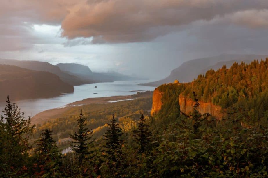
- How many days do you need? 1-3 days
- Starting Point: Troutdale (closest airport- PDX- 13 miles)
- Total miles: 75 miles (+ to and from airport and extra days)
- When is peak fall foliage? Late September to Mid October
One of the most beautiful fall foliage drives in the country is the Historic Columbia River Highway Scenic Byway through the Columbia River Gorge in Oregon. This is America’s first scenic highway and a National Historic Landmark.
The highway winds along the top of the basalt cliffs that flank the river, and the forest of fir, cottonwood, ash, and maple that dot the hills create a beautiful portrait of nature. Beginning in Troutdale and rejoining the interstate highway in The Dalles, this 75-mile trip will take 3-5 hours of drive time depending on how often you stop. It’s a fabulous day trip from portland or a nice detour on your way toward your destination east.
There are many wonderful natural and manmade wonders to take in along your drive. Foremost are the enchanting waterfalls that flow off the cliffs, including 620-foot high Multnomah Falls, one of the highest in the country. The Historic Highway also passes the base of four other notable waterfalls. You’ll also pass right by Crown Point and the famous Vista House atop the cliffs. This beautiful octagonal building with a green tile roof is one of the most recognizable features and a must for any Gorge traveler.
Further along in Cascade Locks, you can view the magnificent Bridge of the Gods, and toward the end of your drive, you can take a break at the Rowena Crest Viewpoint. The iconic horseshoe curve in the road seen from the viewpoint is one of the most photographed places in Oregon.
Columbia River Highway Sample Itinerary
Day 1:
- Morning: Arrive in Portland
- Afternoon: Strol lthorugh the Japanese Gardens
- Evening: Take a dinner cruise with Portland Spirit & and find a place to stay nearby.
Day 2:
- Morning: Start your drive along the Columbia River Highway & stop at Multnomah Falls.
- Afternoon: Enjoy the drive and make sure to stop at the waterfalls and viewpoints.
- Evening: Rowena Crest Viewpoint for Sunset & find a place to stay near Maupin, OR
Day 3:
- Morning: Take a hike in Mount Hood National Forest.
- Afternoon:
- Evening: Head back towards airport
As experienced by Tawnya at Money Saved Money Earned
The Olympic Peninsula Loop
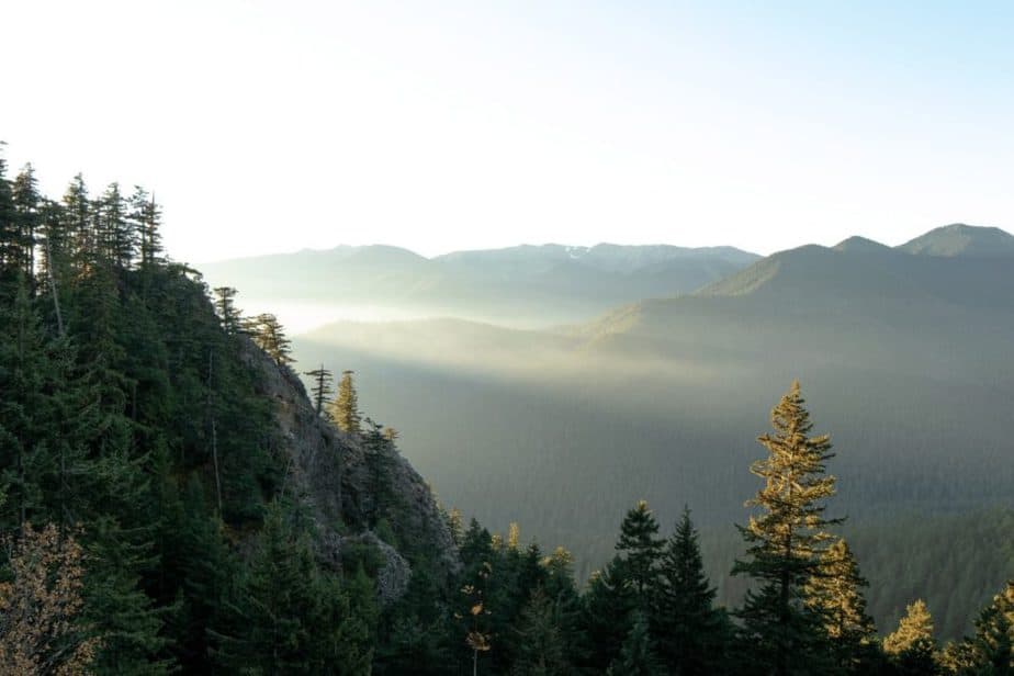
- Days Needed: 4-5 days
- Starting Point: Seattle
- Total Miles: 694 miles (+ to and from airport)
- Peak Fall Foliage:Late September to Mid October
The Olympic Peninsula Loop is one of the best road trips from Seattle. The 694-mile road trip is best experienced in three or more days as there are many places to explore. This is a great trip for outdoor enthusiasts – campers, hikers, and beach lovers and a great USA road trip to take this Fall.
The best time to explore is during late September as the temperature starts to cool and there will be fewer crowds, but keep in mind that the higher elevation places in the mountains will experience freezing temperatures.
Start in Seattle and drive south through Tacoma, then head to the charming seaport of Port Townsend. With a population of less than 10,000, this was one of the busiest ports in Washington state in the mid-1800s. Today it’s known for its Victorian architecture, natural beauty, and seafood.
From Port Townsend head to Sequim – the town will have you feeling like you’re in the South of France, from lavender farms to quaint cafes and friendly locals. Pop into Salty Girl Seafood Co for local oysters then, go for a walk at Sequim’s Dungeness National Wildlife Refuge – the longest natural sand spit in the United States.
From Sequim, head west on Highway 101 for your first taste of Olympic National Park fall beauty. Chase waterfalls, go kayaking on Lake Crescent, hike to Sol Duc Falls or Graves Creek Nature Trail in the Quinault Rain Forest.
The best way to return back to Seattle is by Bremerton Ferry, park your vehicle, and sit on the top deck to take in the views of the Pacific Northwest.
The Olympic Peninsula Loop Sample Itinerary
Day 1:
- Morning: Arrive in Seattle
- Afternoon: Explore the Pike Place Market and Visit the infamous Gum Wall
- Evening: Take a sunset ferris wheel ride & find a place to stay near Seattle.
Day 2:
- Morning: Head south through Tacoma
- Afternoon: Explore Port Townsend & rent a bike down the Larry Scott Memorial Trail along the water.
- Evening: Grab a bite to eat at the Key City Fish Company & find a place to stay nearby.
Day 3:
- Morning: Head to Sequim
- Afternoon: Visit the Purple Haze Lavender Farm and the Olympic Game Farm- Eat Lunch at Salty Girl Seafood Co.
- Evening: Take a hike and watch the sunset at Sequim Bay State Park or at Sequim Dungeness National Refuge. Stay near Sequim.
Day 4:
- Morning: Head west on Highway 101 to Olympic National Park
- Afternoon: Kayak on Lake Cresent
- Evening: Hike Sol Duc Falls (1.6 miles) & stay near the park.
Day 5:
- Morning: Hike Graves Creek Nature Trail (.9 miles)
- Afternoon: Take the Bremerton Ferry back towards Seattle.
- Evening:
As experienced by Chelsey from Chelsey Explores
Booking.comPacific Coast Highway
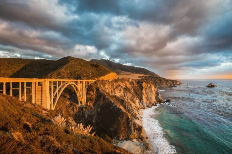
- Days Needed: 6-14 days
- Starting Point: San Diego
- Total Miles: 575 miles
- Peak Fall Foliage: Late October to early November
Driving the Pacific Coast Highway, from San Diego to San Francisco is a road trip to do in a lifetime. And fall is one of the best times to do so: the weather is great, the kids are back to school and so are most tourists.
The drive between San Diego and San Francisco, via the Pacific Coast Highway, is about 575 miles. But you’ll want to take your time and stop along the way. A minimum of one week would be needed, but two weeks would be ideal to really enjoy the beauty of the drive and its coastal towns.
In San Diego, you’ll want to stop in Old Town San Diego, at Balboa Park as well as one of the famous beaches (La Jolla, Pacific Beach, or Mission Bay). Don’t miss the SoCal Taco Festival of San Diego taking place at the end of October.
In Orange County, towns like Laguna Beach, Newport Beach, and Huntington Beach are definitely worth a stop. Arriving in the Los Angeles area, be prepared to spend a few hours stopped in traffic, whether it’s rush hour or the middle of the afternoon. Be patient.
Near Los Angeles, you may want to splurge a little and spend a day at Disneyland in Anaheim, or relax by the beach in Manhattan Beach or Santa Monica Beach. (Here’s a weekend itinerary to Los Angeles if you have more time!)
Once the craziness of Los Angeles county has passed, make a stop in beautiful Santa Barbara and take a small detour to visit the Danish town of Solvang, before making your way into Big Sur.
On your way to Big Sur, stop at Hearst Castle and at the Elephant seals viewpoint. When entering Big Sur, slow down, take your time and admire the beauty of the cliffs and ocean.
Then, you’ll want to stop at the Monterey Aquarium, visit the Santa Cruz boardwalk and participate in the Santa Cruz Mountain Sol Festival in mid-September. Then, slowly head to San Francisco where you can enjoy the Fisherman’s wharf, the Painted Ladies, and the beautiful Golden Gate Bridge.
Pacific Coast Highway Sample Itinerary
Day 1:
- Morning: Arrive in San Diego
- Afternoon: Beach day at La Jolla
- Evening: Explore Old Town & find a place to stay near San Diego
Day 2:
- Morning: Drive to Los Angeles
- Afternoon: Beach day at Santa Monica Beach
- Evening: Find a place to stay near Anaheim, CA
Day 3:
- All day: Splurge on a day in Disneyland
Day 4:
- Morning: Start your drive north.
- Afternoon: Stop in Santa Barbara & rent an electric bike to see the city.
- Evening: Explore the Danish town of Solvang.
Day 5:
- Morning: Start driving towards Big Sur and stop at Hearst Castle and the Elephant Seals Viewpoint
- Afternoon: Admire the views of Big Sur
- Evening: &find a a place to stay nearby
Day 6:
- Morning: Head towards San Fransisco
- Afternoon: Visit the aquarium and the Santa Cruz Boardwalk
- Evening: Sunset at the Golden Gate Bridge
As Experienced by Emilie at Love Life Abroad
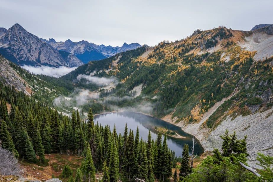
North Cascade Loop in Washington State
- Days Needed: 3-5 days
- Starting Point: Seattle
- Total Miles: 500 + miles
- Peak Fall Foliage: Late September to Mid October
There are many beautiful places to see fall colors in the U.S. and believe it or not, Washington state is one of them. If you’re able to take a drive across the North Cascade Loop, you’re in for a colorful treat!
The bright yellow Aspen, red oak, red vine maple, and multi-colored Ash look exceptionally stunning next to the evergreens you’ll find all along the way.
Late September through mid-October are the best times to visit, although prime viewing for the best colors can vary by as much as two weeks, depending on the weather. If the area receives a heavy rain or windstorm, the trees may lose all their leaves early in the season.
It’s important to note that part of the Loop closes from mid-November to April, but fall colors are gone by then anyway.
If you’re planning a day trip from Seattle, you’ll need a total of about 10 hours to make the complete loop. You’ll want to give yourself plenty of time to make stops along the way as there’s so much to see!
If you decide to make it a longer trip, Winthrop is a fun little town to spend the night. There are several great choices for places to stay, including Abbycreek Inn.
Columbia River Highway Sample Itinerary
Day 1:
- Morning: Arrive in Seattle
- Afternoon: Explore the Pike Place Market and the infamous Gum Wall
- Evening: Ferris wheel at susnet
Day 2:
- Morning: Start the North Cacade road drive
- Afternoon: Hike Cascades Pass Trail (6.5 miles)
- Evening: & find a stay in Winthrop (Abbycreek Inn is a great option)
Day 3:
- Morning: Continue on the loop towards Leavenworth, WA and explore the charming European streets
- Afternoon: Go horseback riding with Eagle Creek Ranch
- Evening: Hike the Icicle Gorge Trail (4.5 miles)
As experienced by Karee at Our Woven Journey
USA Fall Road Trips in the Southwest
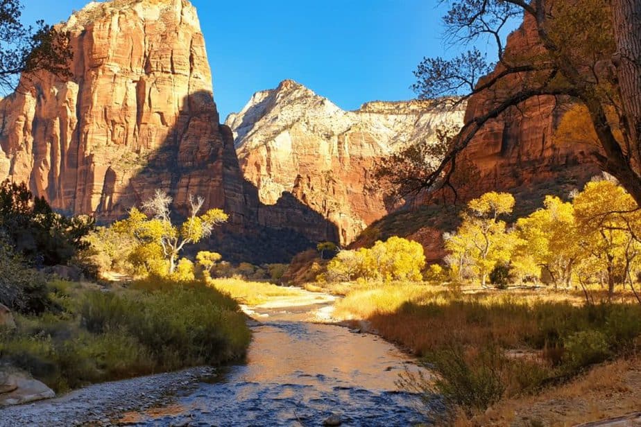
Zion National Park
- Days Needed: 2 days
- Starting Point: Zion National Park
- Total Miles:
- Peak Fall Foliage: Late September- Early October
Fall is a great time to visit Zion National Park in Utah – the temperatures are mild, the crowds are gone and the fall colors are on full display.
Zion is one of the best national parks in Utah to see fall colors thanks to its tree coverage.
Mid-to-late September is the best time to visit Zion to enjoy the fall colors along many hiking trails in Zion. During the day, temperatures hover around low 70s and at night you can expect mid to low 40s. If you plan to spend your day in Zion, make sure to dress in layers as the temperature in the morning is typically cooler than in the afternoon.
Canyon Overlook Trail is one of the best fall hikes in Zion where you can see the foliage in its full glory. This is an easy 1-mile hike that is great to do at any time of the day and it’s particularly beautiful during the sunset.
Another great fall hike is Riverside Walk. This fully paved 2-mile walk is one of the best ways to see fall colors in Zion if you are limited on time.
Zion Fall Road Trip Sample Itinerary:
Day 1:
- Morning: Arrive in Zion
- Afternoon: Hike the Canyon Overlook Trail (1 mile)
- Evening:
Day 2:
- Morning: Get on the first shuttle to hike Angels Landing
- Afternoon: Take a stroll along the Riverside Walk (2 miles)
- Evening:
Tip! If you have extra time, make a pit stop at Kanarra Creek Falls. Be sure to get a hiking permit ahead of time though!
As Experienced by Daria from The Discovery Nut
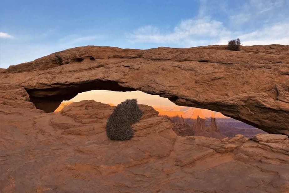
Denver to Moab
- How many days do you need? 5-7 days
- Starting Point: Denver, CO
- Total Miles: 355 miles
- Peak Fall Foliage: Mid September- Late October
One of the best fall road trips in the United States is spending quality time with nature between Denver, Colorado, and Moab, Utah. This 355-mile road trip can be done in as short as 5.5 hours, but you’ll want to stop at all the stunning scenery in between to explore mountains, lakes, wineries, canyons, and more. Plan to spend at least 5 days on this adventure, but 7 days (or more) is better!
To make the most of your road trip from Denver to Moab, start your journey in late September to early October. This will allow you to experience peak fall foliage along the route and through the mountains. Not to mention it’s the perfect weather for hiking through all the picturesque places you’ll encounter.
Start your road trip from Denver and head to Rocky Mountain National Park to catch their peak colors. Then continue on to Breckenridge, Vail, and Glenwood Springs to take in the quaint mountain towns with autumn colors before the first snowfalls. Next up, continue your road trip to Aspen, Maroon Bells, Colorado Wine Country, and Colorado National Monument.
These awesome outdoor locations allow you to maximize the amazing fall weather and will lead you up to your endpoint in Moab, Utah, the perfect adventure destination for the fall. Here you’ll find fewer crowds and cheaper accommodations than in the summer to fully enjoy the fabulous Arches National Park and Canyonlands National Park.
Denver to Moab Sample Itinerary:
Day 1:
- Morning: Arrive in Denver, CO and head to Rocky Mountain NP
- Afternoon: Choose one of the many beautiful hikes in the park deciding on the difficulty you are wanting!
- Evening: Find a place to stay near the park!
Day 2:
- Morning: Head to Breckenridge and stroll the charming mountain town roads.
- Afternoon: Tour a gold mine or rent a bike to explore more of the town
- Evening: Head towards Aspen and find a place to stay.
Day 3:
- Morning: Arrive in Aspen
- Afternoon: Hike to Maroon Bells
- Evening: Continue driving towards Moab
Day 4:
- Morning: Arrive in Arches NP and hike to the Delicate Arch (3.2 miles)
- Afternoon: Hike to the many other arches in the park.
- Evening: Find a place to stay nearby
Day 5:
- Morning: Canyonlands National Park & hike to the Mesa Arch (.7 miles)
- Afternoon:
- Evening: Hike the grand viewpoint trail for sunset (1.8 miles)
As experienced by Julia at The Cure for Curiosity
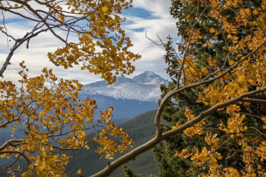
Denver to Estes Park
- How many days do you need? Three days minimum
- Starting Point: Denver, CO
- Total miles: Approximately 80 miles
- When is peak fall foliage? Mid-September to Late October
Awe-inspiring vistas, gorgeous fall foliage, and world-class hiking trails are just a few of the highlights of driving from Denver to Rocky Mountain and Estes Park.
Starting from Denver, this road trip will take you straight into the heart of the mountains and some of the best spots to experience the best fall in Colorado has to offer. Your first stop will be the ever-alluring Rocky Mountain National Park, where you can continue exploring the road by hitting Trail Ridge Road, which is considered one of the most gorgeous drives in the USA for colorful aspens and quintessential autumn colors.
Another incredible way to experience the beauty of the area is by hitting a few trails in both Rocky Mountain and Estes Park, where you’ll find hikes lined by aspens as well as get a once-in-a-lifetime chance to spot elk, especially if you visit during early October (mating seasons).
Estes Park is another must in your itinerary, it’s located very close to Rocky Mountain (and it’s where you’ll find accommodation options if you’re not too keen on camping at Rocky Mountain). While here, you can spend the day soaking in its mountain town vibes or hitting a few hiking trails in the area. If you’d love a bit more solitude and more fall colors, you can drive a bit further afield into the nearby Indian Peaks Wilderness, where you’ll be treated to some more mountain goodness and iconic vistas.
Estes Park becomes host to the yearly Elk Festival every early October, where you can get the chance to learn all about these fascinating animals through live music, educational activities, Native American storytelling, and more!
Denver to Estes Park Sample Itinerary
Day 1:
- Morning: Arrive in Denver, CO
- Afternoon: Drive to Rocky Mountain National Park and drive the Trail Ridge Rod
- Evening: Sunset hike on Gem Lake Trail (3.1 miles)
Day 2:
- Morning: Hike the Sky Pond Tail (9.4 miles) or The Emerald Lake Trail (3.2 miles) if looking for an easier hike.
- Afternoon:
- Evening: Find a place to stay near Estes Park.
Day 3:
- Morning: Hike to Lake Isabelle in the Indian Peaks Wilderness (5.5 miles)
- Afternoon: Elk Festival in Estes Park (if trip is timed around this).
- Evening: Head back towards your stay or airport.
As experienced by Meg of Fox in the Forest
Fall Road Trips to take in the Midwest
North Shore of Lake Superior, Minnesota
- How many days do you need? 2-4 days
- Starting point: Duluth, Minn. (Closest airport MSP; regional DLH)
- Total miles once at starting point: 150 miles one way (+ to and from airport + extra days)
- When is peak fall foliage? Mid-September to early October
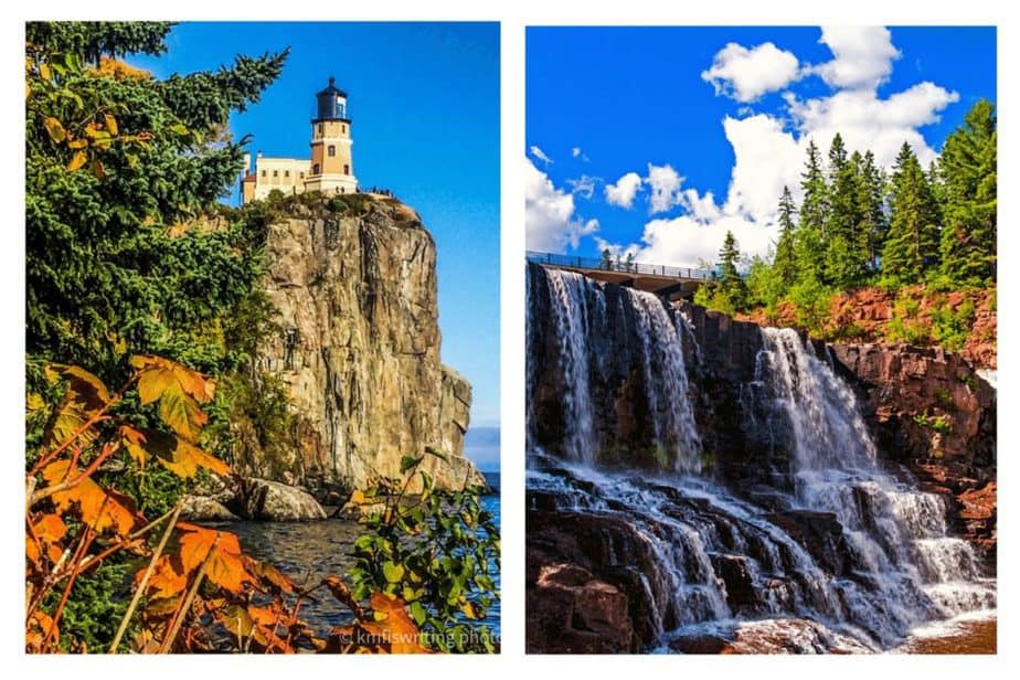
While Minnesota is known as the Land of 10,000 Lakes (actually 11,842), the state is also home to 17.6m acres of forestland. Lots of beautiful leaf-peeping opportunities in the fall. And the most scenic road trip to take this fall in Minnesota and in the midwestern U.S. is the North Shore of Lake Superior. Starting in Duluth, Minn., Highway 61 hugs the shores of Lake Superior for 150 miles until it reaches Grand Portage on the Canadian border
Enjoy scenic overlooks, bluff views, sheer cliffs, waterfalls, hiking trails, lighthouses, rocky shores, a pink beach, a black beach, and more on this road trip. Technically, you could drive the entire North Shore in a day. However, you don’t want to miss all the stunning day hikes and photo-op stops along the way. Allow at least two to four days to appreciate one of the best USA road trips to take this fall.
Fall foliage season along the North Shore in Minnesota starts in mid-September and runs through early October. But be prepared because the area can receive measurable snowfall during that timeframe.
One of the best places to chase fall colors on this road trip is Lutsen Mountains. You can take the Summit Express Gondola up 1,000 feet to a mountaintop chalet. Panoramic views treat you to sweeping views of Lake Superior and Sawtooth Mountains. And one of the best views from the shores of Lake Superior is at Split Rock Lighthouse State Park.
The North Shore in Minnesota is truly one of the best road trips to take this fall in the U.S.
Sample North Shore in Minnesota Road Trip Itinerary
Day 1:
- Morning: Canal Park in Duluth, Minn., the gateway to the North Shore along Lake Superior – the largest freshwater lake in the world (350 miles long and 160 miles wide); historic aerial lift bridge; lighthouse.
- Afternoon: Skyline Parkway; Enger Park where you can climb the 80-ft. Enger Tower for great views; Glensheen Mansion and gardens.
- Evening: Stay at Beacon Pointe Resort, which is next to the scenic 7.5-mile Lakewalk along Lake Superior.
Day 2:
- Morning: Sunrise on Lake Superior. Agate Bay Lighthouse and Betty’s Pies in Two Harbors, Minn.; Silver Creek Cliff Tunnel and Wayside Park for stunning views of Lake Superior – take a short walk across the pedestrian bridge on Gitch-Gami State Trail.
- Afternoon: Pink pebble beach at Iona’s Beach Scientific and Natural Area; Gooseberry Falls State Park (features four waterfalls); Split Rock Lighthouse State Park.
- Evening: Stay at Cove Point Lodge in Beaver Bay, Minn. right on the rocky shores of Lake Superior.
Day 3:
- Morning: Black Beach Park in Silver Bay, Minn.; gorgeous trails through fall foliage and alongside waterfalls at Tettegouche State Park; breathtaking sheer cliffs rising 300 feet above Lake Superior at Palisade Head (no railings so use caution).
- Afternoon: Temperance River State Park in Tofte, Minn. – hiking trails on the west side through wooded areas and steps leading down to a bridge and the shores of Lake Superior on the east side of the most scenic road trip in the Midwest.
- Evening: Stay at Caribou Highlands Lodge in Lutsen, Minn. and enjoy dinner at onsite restaurant, Moguls Grille & Tap Room. Recommendation: Reserve two nights and also stay at Caribou Highlands Lodge on your way back after Day 4.
Day 4:
- Morning: Summit Express Gondola at Lutsen Mountains; Cascade River State Park and Overlook; Lighthouse in Grand Marais, Minn.
- Afternoon: Judge C.R. Magney State Park in Grand Marais, Minn. (cardio workout to two different waterfalls with rewarding views); Grand Portage State Park in Grand Portage, Minn. (features Minnesota’s tallest waterfall and you can see three nations from here: U.S., Canada and the Grand Portage Nation).
- Evening: Stay a second night at Caribou Highlands Lodge in Lutsen, Minn. Or you could drive to the Minnesota-St. Paul International Airport in the Twin Cities (five-hour drive from Grand Portage).
As experienced by kmf from kmfiswriting.com
Missouri Ozarks
- Days Needed: 3 days
- Starting Point: St. Louis or Kansas City
- Total Miles from St. Louis: 263 miles
Total Miles from Kansas City: 220 miles - Peak Fall Foliage: Mid to Late October
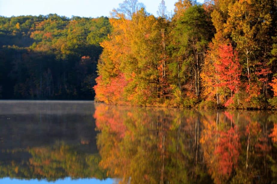
A little over three hours from both St. Louis and Kansas City is some of the most beautiful fall foliage in the midwest and a great USA road trip to take this fall.
Branson sits at the base of the Missouri Ozarks and they are a great fall destination and road trip for gorgeous autumn leaves. The peak of the fall colors typically occurs in mid-to-late October when the maples, ashes, oaks, and hickories are at the height of their beautiful hues.
The region is known for an abundance of sparkling springs, waterfalls, lakes, caves, and caverns, but in fall it’s all about the leaves. Branson is known for its live entertainment, with shows covering just about every genre of music.
2-3 days is a perfect road trip to the Ozarks to see branches of green change to the beautiful fall colors of red, orange and yellow. There are several options to see the gorgeous fall colors by air, boat, and car.
During the day, explore the nearby Ozarks and at night enjoy live entertainment at one of the many Branson theaters! For the ultimate fall color adventure experience, zipline through the Ozark Mountains at Shepherd of the Hills or at Wolfe Mountain.
Early fall is still warm enough to enjoy a boat excursion where you will be surrounded by the beautiful forest and the fall leaves. A popular option is Lake of the Ozarks Water Taxi tour. If you are interested in a sunset experience, Cruise Lake of the Ozarks is a great option for a sunset dinner cruise.
The 165 Scenic Overlook is a 22-mile stretch of Route 265 with beautiful views of Table Rock Lake and the Table Rock Lake Dam. Another beautiful fall scenic overlook is located inside the Ruth and Paul Henning Conservation Area with a 40-foot-tall viewing tower atop a formation known as Dewey Bald, where views of the White River hills await.
All of these options are a great way to explore the fall colors and beautiful vistas on a road trip to Branson and the Ozarks.
Sample Missouri Ozarks Fall Road Trip Itinerary:
Day 1:
- Morning: Arrive in Branson, MO
- Afternoon: Drive the 165 Scenic Overlook
- Evening: Sunset Dinner Cruise & find a place to stay near Branson
Day 2:
- Morning: Zipline at Wolfe Mountain
- Afternoon:
- Evening: Branson Live Entertainment
Day 3:
- Morning: Ruth and Paul Conservation and overlook
- Afternoon:
- Evening: Head Home
As experienced by Alexa at Travel in Missouri
Fall Road Trips to Take in the South
St. Augustine, Savannah, and Charleston

- Days Needed: 3-5 days
- Starting Point: St. Augustine
- Total Miles: 275 miles (one way)
- Peak Fall Foliage: Late October- Early November
Not only is the Fall a perfect time to see the changing of the leaves, but it is also the perfect weather to visit the South! Gone are the hot and humid days of summer, and as an added bonus, it does not get that cold either.
The cooler weather signals the change and it is a myth that you cannot see gorgeous Fall colors in Florida. You can begin your road trip in St. Augustine and head to the Ormond Scenic Loop Trail where you can see red maple and hickory trees and maybe a dolphin or whale as well. Stop by in town to learn about Florida’s history and St. Augustine, the oldest city in the US, and even see the mythical Fountain of Youth.
The best time for this road trip is in October to November for peak Fall colors. Continue your journey north and drive four hours to Savannah, Georgia. When you think of the South and trees covered in Spanish moss it is probably the picture-perfect Wormsloe Historic Site. Its main driveway sheltered by live oaks and moss is Instagram-worthy and there are trails for a bit of hiking to see the ruins of the colonial estate of Noble Jones. The home is the oldest standing structure in Savannah.
Charleston is two hours away and the port city is the site of the first shots of the Civil War. There are many storied homes, bars, and restaurants in downtown, all circled around the historic City Market. And what is a trip to the South without a visit to a plantation? Luckily, the Magnolia Plantation and Gardens also burst with Fall leaves and flowers too.
Florida to South Carolina Sample Fall Road Trip Itinerary:
Day 1:
- Morning: Arrive in St. Augustine, FL
- Afternoon: Hike the Ormond Scenic Loop
- Evening: Explore downtown St. Augustine and find a place to stay nearby.
Day 2:
- Morning: Head towards Savannah, GA
- Afternoon: Check out the ruins of the colonial estate of Noble Jones
- Evening: Explore the charming dowtown streets & stay in Savannah, GA
Day 3:
- Morning: Head to Charleston
- Afternoon: Visit the Magnolia Plantation and Gardens
- Evening: Take a historic horse and carriage ride
As experienced by Bernadette Young of Explorer Chick
Miami to Key West, Florida
- How many days do you need? 2-3 days
- Starting point: Miami
- Total Miles: 166 miles
- Peak Fall Foliage: Early November to Mid November (of course not as vibrant as the other states)
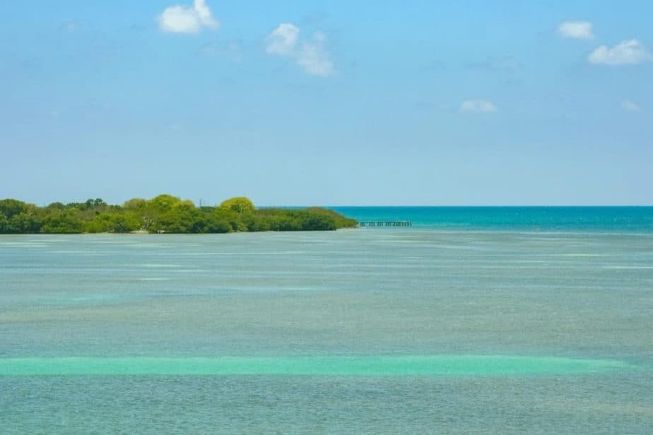
One of the best USA road trips to take this Fall is to drive the 166 miles from Miami to Key West, Florida on Highway A1A. Driving straight through will take you about 3 1/2 to 4 hours, but make no mistake, you are going to want to stop — so allow for 2-3 days at the least.
While the Fall color in the subtropics may not be as dramatic as in the northern USA, when temps become moderate and the summer humidity passes, this is the perfect time of year for this drive.
Along the way, you’ll find beautiful beaches, unique attractions, salty seaside bars, and plenty of tropical color in bloom. Trees native to the Keys are no longer bearing fruit, but the leaves and blossoms shimmer and glisten in the changing Fall sun.
Begin your adventure by having the best fish tacos at Alabama Jacks in Key Largo. The next stop is Islamorada — the “Sport Fishing Capital of the World” — where you can visit the History of Diving Museum and hand-feed giant tarpon at Robbie’s. Marathon in the middle keys is a great place to spend a night or two if you have the time. Another 50 miles and you’ll be in Key West.
The Conch Republic of Key West has festivals year-round and there are plenty going on in the Fall. Make the trip in September for Womenfest or the Musicians Festival. Go in October to help celebrate the Conch Republic’s most colorful event, Fantasy Fest. Plan on a week or at least a long weekend to enjoy this ideal Fall road trip.
Key West Fall Road Trip Sample Itinerary
Day 1:
- Morning: Arrive in Miami and start your drive!
- Afternoon: Lunch at Alabama Jacks and a stop at Islamorado.
- Evening: Find a spot to stay in Marathon.
Day 2:
- Morning: Head to Key West.
- Afternoon: Beach day!
- Evening: Find a spot to stay in Key West.
Day 3:
- Morning: Celebrate Fantasy Fest (October)
- Afternoon:
- Evening: Head back towards the airport or extend your trip for more beach days!
Talimena Scenic Byway- Talihena, Oklahoma to Mena, Arkansas
- How many days do you need? 1-3
- Starting Point: Mena, AR (closest major airports- DFW- 268 miles, OKC- 239 miles)
- Total miles: 54 miles (+ to and from airport)
- When is peak fall foliage? Late October – Early November
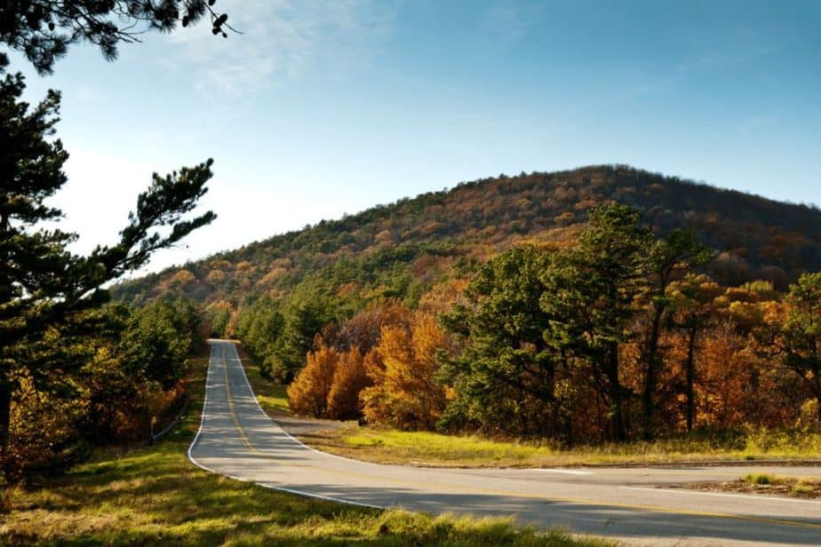
The Talimena Scenic Byway is a stretch of U.S. Highway 62 that goes from Mena in Arkansas to Talihina in Oklahoma. It follows the old Talimena Drive that runs through the Ouachita National Forest in Arkansas and Oklahoma. It was designated a National Scenic Byway in 2005. It is a favorite of motorcycle enthusiasts, who can take their bikes on the scenic route.
The route has been designated as an official “National Scenic Byway” by the United States Department of Transportation, and is one of only nine such routes in America so designated because of its “scenery, historic significance and recreational opportunities.” It’s also one of the most beautiful scenic drives in Oklahoma and Arkansas.
The Talimena Road is also known for its views, which include mountain ranges and an old-growth forest on the Eastern escarpment, as well as the Ouachita Mountains to the west.
The best time to do this drive is in October and November because it is a famous road trip for its fall foliage. There’s a balloon festival held annually in Talihina in October that is the perfect time to plan your trip.
The drive is open all year round, it’s just best to contact the National Forest Service beforehand. The road has some rough patches so it’s not advisable for those driving RVs or low-profile vehicles.
While you can make the drive in one day, it’s best to break it up and spend a day in Talihina, one day on the drive itself, and one day in Mena.
Talimena Scenic Byway Sample Road Trip Itinerary
Day 1:
- Morning: After arriving in Mena, AR
- Afternoon: Picnic at Cossatot River State Park
- Evening: Sunset hike Lover’s Leap Trail (Queen Wilhelma SP, 1.1 miles) & find a stay near Mena, AR
Day 2:
- Morning: Drive the Talimena Scenic Byway Making sure to stop at all the overlooks!
- Afternoon:
- Evening: & find a stay in Talihena
Day 3:
- Morning: Talimean Hot-air Balloon Festival
- Afternoon:
- Evening: Head back towards the aiport
Hint: Flying into DFW? Check out this list of 31 Adventurous Things to Do near Dallas during your trip OR extend your trip with a cozy cabin weekend getaway to Broken Bow!
As experience by Stephanie Craig from Oklahoma Wonders
Psst! Check out these fun road trip games to pass the time while driving!
Be the first to comment