14+ Hikes in Switzerland That NEED To Be On Your Bucket List!
Switzerland was truly a bucket list vacation for me. From epic waterfalls (everywhere you look) to snow-capped mountains as far as the eye can see, it’s a true outdoor-lovers paradise. Although I spend most of my time hiking in the USA (which I will forever be obsessed with), the hiking in Switzerland is hard to beat. I’m excited to share this list of the very best hikes in Switzerland!
Side note: I only spent 7 days exploring this amazing country, so I haven’t been able to check out all the hikes. I reached out to fellow travel bloggers to compile this epic list of breathtaking Switzerland hikes!
This site contains affiliate links to products. I may receive a commission for purchases made through these links at no extra cost to you. There are only products included that I truly love. I APPRECIATE your support!
Table of Contents
Best Day Hikes in Switzerland
Let’s start out with the best day hikes in Switzerland. I have sorted the following hikes from shortest to longest so you can pick the ones that best fit your hiking style! Plus, here’s a map to help you plan your Switzerland hikes!
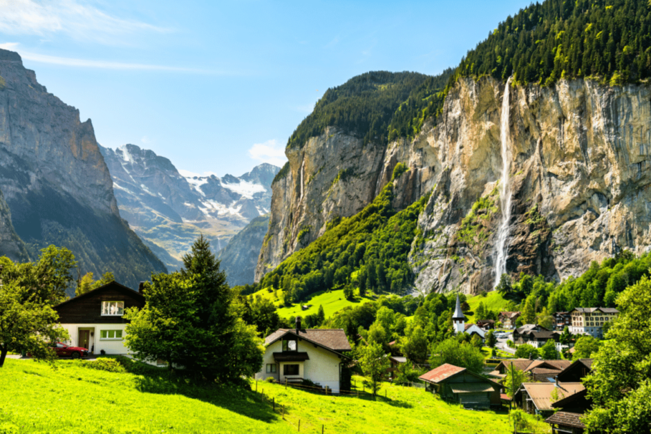
1. Staubach Falls
- Location: Lauterbrunnen, Bern
- Distance of hike/Elevation Gain: .4 miles/367 feet
- Fee: Free
- Closest Train Station: Lauterbrunnen
- Where to stay: Hotel Staubbach (Panorama views of the village and Staubbach Falls and just 2,000 feet from the train station)
I’m sure you have seen pictures of this picturesque waterfall plastered all over Instagram. It’s actually the highest freefalling waterfall in all of Switzerland AND it’s easily accessible right in the Lauterbrunnen Valley.
After taking a train to the Lauterbrunnen station, you can easily reach Staubach falls on foot (10-minute walk) or by bus.
After arriving, you can head up the short trail (.4 miles round trip) to walk behind the falls. Although short, it is a pretty steep and crowded trail to the top so make sure to factor in at least 30 minutes for the hike.
2. Trummelbach Falls
- Location: Lauterbrunnen, Bern
- Distance of hike/Elevation Gain: Depends if you take the elevator half way up/down. Expect to spend 1-2 hours exploring.
- Fee: 14 CHF
- Closest Train Station: Lauterbrunnen
- Where to stay: Wasserfallhusli (Cozy chalet-style rooms with some of the best views of the city from the balconies)
From Staubaach Falls, catch the next bus (bus 141) to the Trümmelbachfälle stop. After a short walk, you’ll see a line to buy tickets for Trümmelbach Falls. It was only 14 CHF, and completely worth it IMO.
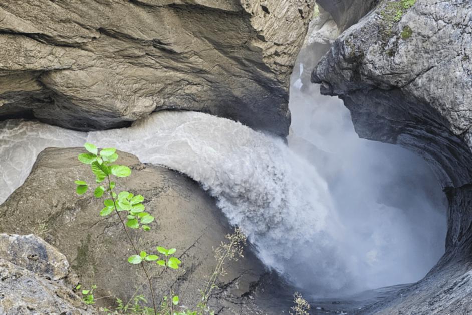
Trummelbach Falls are an impressive set of 10 waterfalls that cut through a mountain. I recommend taking the elevator up (to stop 6) and then walking the entire way down. This way, you will ensure you see all the viewpoints without the trek up 🙂
Expect to spend around 1 hour exploring here.
After checking out the falls, spend the evening walking back through the the village to the train station (about a 45 minute walk). You’ll walk along the river and pass some epic viewpoints.
3. Aare Gorge
- Location: Schattenhalb, Bern
- Distance of hike/Elevation Gain: 1.2 miles/583 feet (one way)
- Fee: 10 CHF
- Closest Train Station: Aareschlucht West or Ost
- Where to stay: Das Hotel Sherlock Holmes
To reach the Aare Gorge, you will need to take a train to Brienz and then connect on a train to Meiringen (10 minutes) and then from Meiringen to Aareschlucht West or Ost (West was closed when we visited).
After your train ride, you’ll have a short walk to the entry of the gorge to purchase your tickets (10 CHF). (There were no signs posted on the walk, but just follow the path up from the Ost station and you’ll eventually see the large entry building).
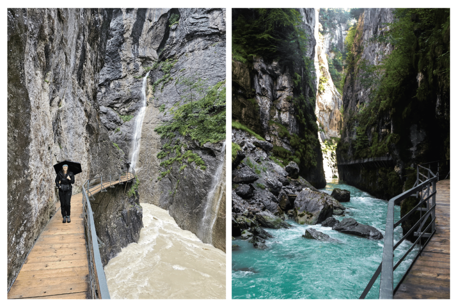
It’s a fun and easy walk through the gorge about 1 mile each way. Since the West train station was closed, we did have to walk there and back to get back to the Aareschlucht OST station.
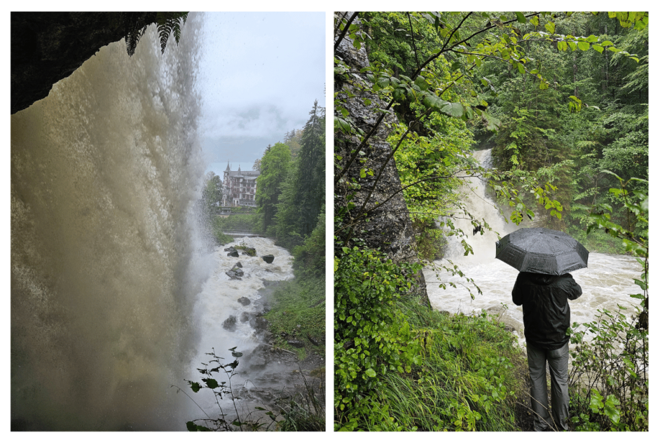
4. Giessbach Falls- Best rainy day Switzerland Hike!
- Location: Brienz, Bern
- Distance of hike/Elevation Gain: 2.3 miles/1072 feet
- Fee: Free (if hiking vs. the funicular)
- Closest Train Station: Brienz, but you will have to take the boat shuttle to Giessbach See
- Where to stay: Grandhotel Giessbach (A historic and seculuded hotel with the BEST views of Lake Brienz and Giessbach Falls)
I think Giessbach Falls is quite the hidden gem of a hike in Switzerland. While most people are flocking to the mountainous trails, the epic waterfalls get left behind. Thankfully for us, the rain gave us the opportunity to check out these underrated falls!
To reach the trailhead, you need to take the boat shuttle from the Brienz Train Station to the Giessbach See stop (included in your Swiss Rail Pass– see boat schedule here).
From here, you have the option to take a funicular to the top of the falls, or hike. We choose to hike as there are many amazing stops and overlooks along the way. Although you can hike further up, we stopped at the point where you walk behind the falls.
Be prepared though, these are some powerful falls and you will likely get soaked!
Keep Reading::: 25+ Adventurous Things to do in the Jungfrau Region of Switzerland!
5. Lake Bachalpsee
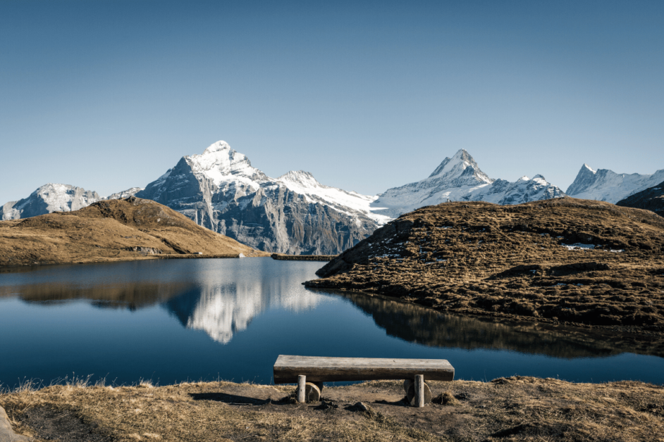
- Location: From Grindelwald, you first take a cable car to reach First station. Lake Bachalpsee is an hour’s hike from here.
- Distance of hike/Elevation Gain: About 3.7 miles/637 feet
- Fee: You only pay for the cable car ride from Grindelwald to First.
- Closest Train Station: Grindelwald
Lake Bachalpsee is one of the beautiful lakes in the Bernese Oberland region of Switzerland. The beauty of this hike is that most of the work is done by the cable car, so you can do this easily even if you are visiting Switzerland with kids. The cable car to Grindelwald First ride offers amazing views of Eiger and other mountains overlooking Grindelwald.
The hike is simple but has breathtaking views. Once you reach Lake Bachalpsee, you will note how serene it is and makes for a perfect photo-op.
As experienced by Shweta from Zest In A Tote
Planning Tip! Debating which train pass you should purchase for your Switzerland vacay?! Check out this full comparison between the Swiss Pass and the Jungfrau Region Rail Pass!
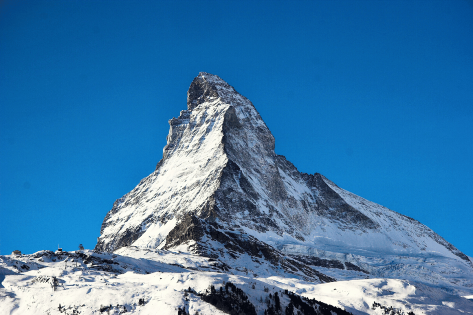
6. Matterhorn Glacier Trail
- Location: Zermatt, Valais
- Distance of hike/Elevation Gain: 3.9 miles / 1,633 ft (direction Schwarzsee – Trockener Steg)
- Fee: No fee for the hike but for the cable cars to and from the hike to Zermatt village.
- Closest Trainstation: Zermatt
- Where to Stay: Alpine Hotel Perren
The impressive Matterhorn Glacier Trail, high above the mountain village of Zermatt, is one of the best hikes in Switzerland. The well-signposted theme trail with the number 26 leads you along below the world-famous Matterhorn. The rocky trail passes mountain lakes, glacier remnants of the upper Theodul glacier and a rugged landscape of ice and stone.
Most hikers start walking from the Schwarzsee mountain station and towards Trockener Steg, as they have less ascent and more descent in this hiking direction.
You will get to witness nature change from green meadows to rocky outcrops at every meter of altitude and when arriving at the trail end at Trockener Steg, you can add another highlight on top: the viewing platform of Klein Matterhorn.
Take the Matterhorn Glacier Ride to the highest mountain station in Europe. At 3,883 meters, the Klein Matterhorn offers a unique 360° panoramic view of 38 Alpine giants over 4000 meters above sea level.
As experienced by Linda of Hiking the Alps
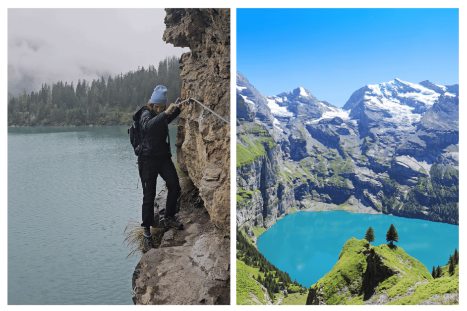
7. Lake Oeschinensee
- Location: Kandersteg, Bern
- Distance of hike/Elevation Gain: 4.5 miles, 1538 feet
- Fee: 30 CHF general, 15 CHF with Swiss Rail Pass for gondola
- Closest Train Station: Kandersteg
- Where to stay: Bernerhof Swiss Quality Hotel
This hike had been on my bucket list for quite some time, and even though the weather did not cooperate with us, it was still amazing!
You’ll start by taking the train to Kandersteg. After arriving, you will have about a 15 minute walk from the train station to the gondola station. It’s flat, paved, and right through town.
After arriving at the gondola station, purchase your tickets (30 CHF general, 15 CHF with Swiss Rail Pass). Once at the top, you’ll then have a 30 minute easy walk to the lake (there is a paid shuttle as well)
Once at the lake, you can choose between different hikes, or walk to the restaurant, or rent a row boat. We hiked to the waterfall (pictured above). It was a short hike, but slightly sketchy as you can see in the picture!
And if you are lucky enough to have dry weather, there is an alpine slide at the mountain station.
8. Ebenalp
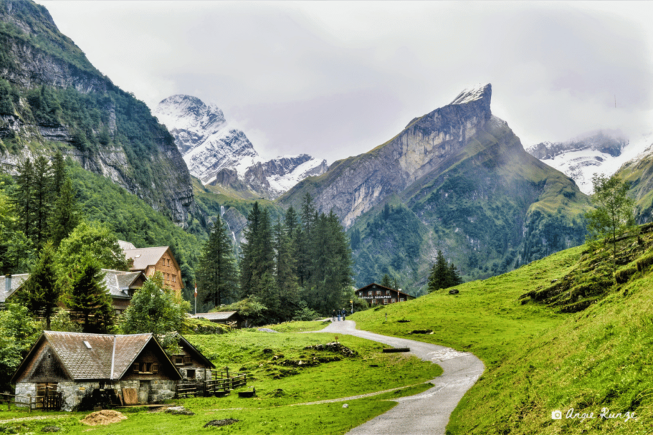
- Location: Wasserauen Switzerland
- Total distance: 4.5 miles (downhill hike recommended)
- Fee: Cable Car (22 CHF one way, 34 CHF return journey)
- Closest Train Station: Wasserauen
- Where to stay: Hotel Alpenrose, Wasserauen
Tiny Ebenalp Mountain is a bit of a hidden gem that holds an entire day’s worth of memorable (and Instagram-able) activities.
Take the quick way up via cable car and hike your way down. At the top you’ll find the cliff hanging Berggasthaus Aescher, a rustic mountain retreat where you can stop and enjoy refreshments.
If you happen to be on the mountain on a Sunday, you are in for a real treat! Locals make their way to church services which are held inside a cave on the mountain. You’ll be treated to the glorious sound of the choir as they perform hymns. These are no ordinary hymns but instead performed in a unique and beautiful style of yodeling called “natural yodel.”
There are several scenic trails on the mountain which eventually lead to the emerald green Seealpsee Alpine lake. Ebenalp is truly one of Switzerland’s best hikes!
As experienced by Angie of We’re Not in Kansas Anymore
9. Harder Kulm- Best hike near Interlaken!
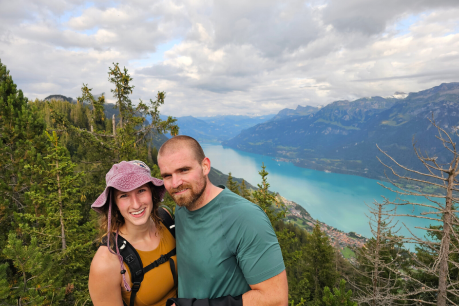
- Location: Interlaken, Bern
- Distance of hike/Elevation Gain: 5.1 miles/2,536 feet
- Fee: Free if hiking up and down
- Closest Train Station: Interlaken Ost
- Where to stay: Hotel Chalet Swiss
Within walking distance from the Interlaken Ost train station, you’ll find the famous Harder Kulm funicular.
From the base of the mountain, you will have the choice to hike up or take the funicular up.
If choosing the funicular, you can purchase your tickets right at the entry (included with the Jungfrau Region Pass, 50% off with the Swiss Travel Pass), and then hop on board 10-minute funicular ride as it climbs almost 2,500 feet.
If hiking, plan for the trek up to take anywhere from 2 to 3 hours as it is pretty steep.
During the ride (or hike) to the top, you’ll be met with unparalleled panoramic views of Interlaken, the Thun and Brienz lakes, and the surrounding mountains.
We actually choose the funicular ride and then explored the trails at the top (which led to THE BEST views with NO crowds). Highly recommend.
Then reward yourself with a pizza from the outdoor restaurant and enjoy dinner with a view!
10. Lungernsee
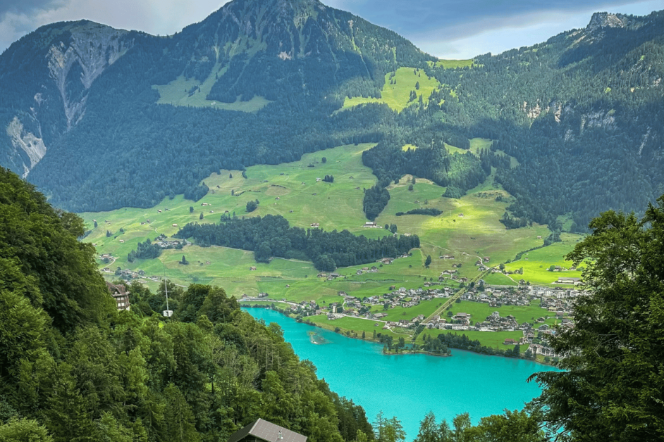
- Location: Lungern
- Distance of hike/Elevation Gain: 6 miles, 551 feet
- Fee: 24 CHF one-way cable car
- Closest Train Station: Lungern Turren Schönbüel
- Where to stay: Elliot’s Bed and Bar
A little over half an hour’s drive from Lucerne lies Lungernsee — a beautiful turquoise lake surrounded by breathtaking mountain views. Usually, people stroll around this lake. Almost no one knows about this panoramic hike with views of Jungfrau mountains, the butterfly paradise, and the picturesque village of Lungern.
The hike starts at the Lungern-Turren cable car for 24 CHF one-way. Alternatively, you can also hike for 2 hours going up. The cable car will take you to Turren, the butterfly paradise, where you can see the largest butterflies living in Switzerland.
From the station, you will go a 15-minute downhill until the zigzag slope going upward to the small summit of Dundelegg (1739m). At the top, you can see the breathtaking Alps landscape.
For the complete experience, walk down around the forest, where you will see waterfalls and a stunning view of the Lungernsee. End your 4-hour hike with a stroll down to the charming village of Lungern.
As experienced by Gladis of Happiness on the Way
11. 5-Seenweg
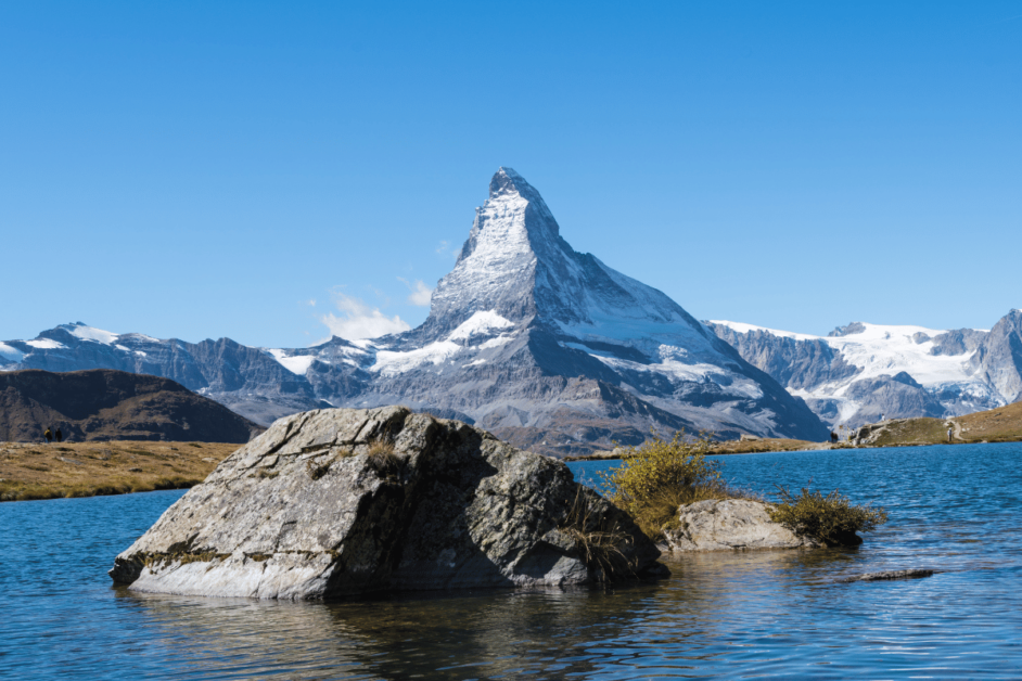
- Location: Zermatt
- Distance of hike/Elevation Gain: 6.8 miles/ 1660 ft
- Fee: the hike is free, but the ride with the combiticket with cable car is CHF 43
- Closest Train Station: Sunnegga Blauherd Rothhorn Funnicular And Cable Car Station
- Where to stay: Hotel Tannenhof in Zermatt
Once you arrive in Zermatt on the Glacier Express, a world of hiking trails are beckoning you to explore the mountains. The 5-Seenweg, or 5 Lake Hike, is a very scenic hike in the mountains around Zermatt.
You go up via the cable car and hike at high altitude from one lake to another. During the hike, you have epic views of the Matterhorn mountain and together with the 5 lakes you’ll visit, this makes for gorgeous views.
The 5 lakes are: Stellisee, Grindjisee, Grünsee, Moosjisee and Leisee. If you hike them in this order, from Blauherd to Sunnegga, you mostly walk downhill because you start at almost the highest point. Only at the end, you’ll hike up to the cable car station.
Almost at the half-way point, you’ll find a nice mountain hut for some rest and food and drinks. Not all lakes are natural or equally beautiful, but each lake has its own charm. Make sure to keep an eye on the time for the last cable car down, otherwise it will be a long descent into Zermatt.
As experienced by Naomi of Probe Around The Globe
12. Panorama Trail Mannlichen to Kleine Scheidegg
- Location: Mannlichen
- Distance of hike/Elevation Gain: 5.9 miles/ 830 ft
- Fee: Free to hike, but cable car to Mannlichen has a fee (free if you purchased the Jungfrau Region Train Pass)
- Closest Train Station: Wengen or Grindelwald (Depending which cable car you take to Mannlichen)
- Where to stay: Hotel Bellevue Wengen (Where we stayed all 6 nights!)
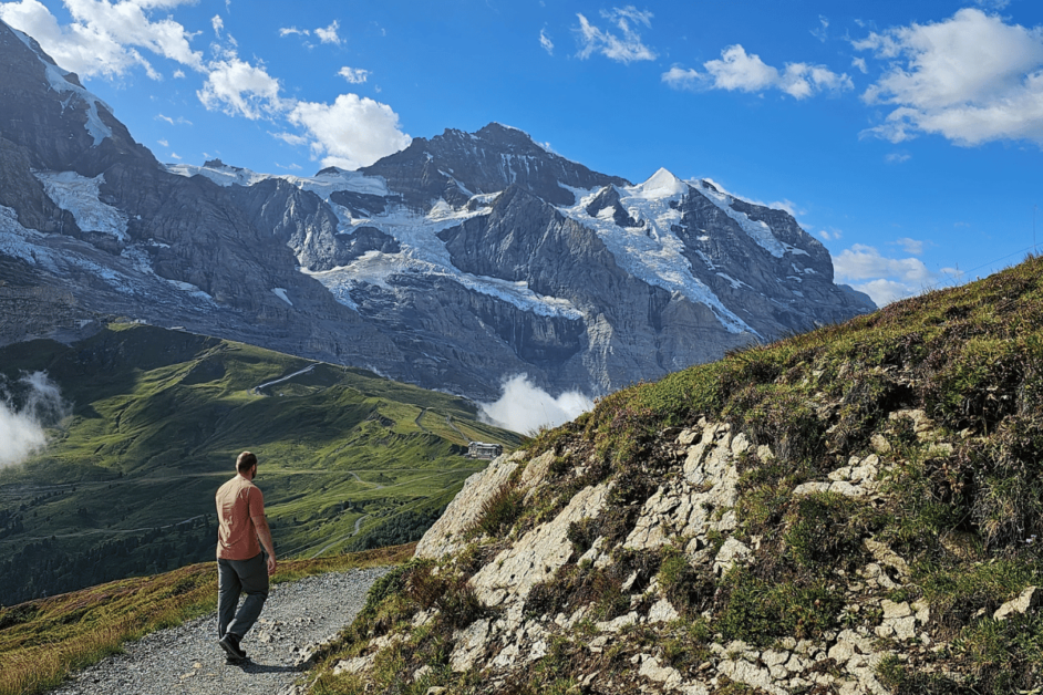
During our ONLY sunny morning during our week in Switzerland, we headed to the picturesque Panorama Trail. To get to this trailhead, you have to take a gondola from Wengen or Grindelwald up to Mannlichen.
After marveling at the coolest mountain playground, you can take off on the trail. The entire way you’ll be surrounded by the most beautiful views while listening to the cow bells ringing. It was truly a magical time and one of the VERY BEST easy day hikes in all of Switzerland.
It’s a pretty easy downhill route that leads to the Kleine Scheidegg station. From here, you can choose to hop on a train or hike back up.
The Best Multi-Day Hikes in Switzerland
For anyone looking for even more of an adventure, you can head out on one of these epic multi-day hikes in Switzerland. With the right preparation and research, these could lead to an unforgettable time!
13. Tour Du Mont Blac
- Location: Easiest to start is from Chamonix or Courmayeur
- Distance of hike/Elevation Gain: The trail is 105 miles and 32,800 ft in altitude.
- Fee: No Fee
- Closest Train Station: Chamonix is the main station
- Where to stay: Hotel du Col de Fenêtre was a great stay with unbelievable views.
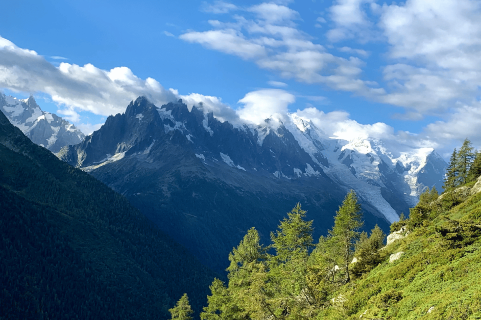
Tour du Mont Blanc (TMB) is easily the best multi-day hike in Switzerland, and maybe even all of Europe.
You hike through three countries (France, Italy, and Switzerland) on an 11-day hike through the Alps. The trail covers and impressive 105 miles and 32,800 feet in altitude gain/loss.
The Tour du Mont Blanc is very well labeled so there is no need for a guide. The Tour du Mont Blanc is a popular trail, so the refugees usually sell out. The refugees’ range in comfort level but all will serve a delicious hot meal and cold beer after a long day of hiking.
The official Tour du Mont Blanc website is fantastic, allowing you to book your stays by calculating how long you want to walk each day. Every day is a new wonder, and it was one of our favorite trips of my life.
As experienced by Steff of JustTravelous
14. Jura Crest Trail
- Location: from Dielsdorf to Nyon (Jura Mountains)
- Distance: about 192 miles and 45,275 feet of elevation gain
- Fee: No fee
- Closest train station: Dielsdorf (start) and Nyon (end)
- Where to stay: Brugg Youth Hostel, here you stay in a castle!
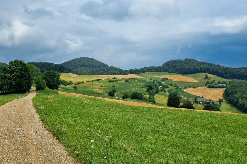
The Jura Crest Trail is a long-distance hike that meanders through the picturesque Jura Mountains, offering hikers a serene and captivating experience. The hike encompasses a variety of terrain, from lush forests to open meadows, and you’ll encounter charming villages along the way.
The trail begins in Dielsdorf, near Zurich, and ends in Nyon on Lake Geneva. The trail is about 192 miles long and divided into 16 stages. Most of the time, the beginning point or the endpoint of a stage has good connections with public transportation, so it’s easy to hike separate stages of the trail.
As experienced by Jacoba of Travel with Co.
Best Hikes in Switzerland
There ya have it! 14 of the most breathtaking hikes in Switzerland. I’m already ready to return and check the rest of these off the list.
Which is first on your Switzerland bucket list?
Be the first to comment